Geldermalsen
| Geldermalsen | |||
|---|---|---|---|
| Municipality | |||
 | |||
| |||
 | |||
| Coordinates: 51°53′N 5°18′E / 51.883°N 5.300°ECoordinates: 51°53′N 5°18′E / 51.883°N 5.300°E | |||
| Country | Netherlands | ||
| Province | Gelderland | ||
| Area(2006) | |||
| • Total | 101.67 km2 (39.26 sq mi) | ||
| • Land | 99.70 km2 (38.49 sq mi) | ||
| • Water | 1.97 km2 (0.76 sq mi) | ||
| Population (1 January 2007) | |||
| • Total | 26,241 | ||
| • Density | 263/km2 (680/sq mi) | ||
| Source: CBS, Statline. | |||
| Time zone | CET (UTC+1) | ||
| • Summer (DST) | CEST (UTC+2) | ||
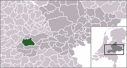
Geldermalsen (![]() pronunciation (help·info)) is a municipality and a town in the western Netherlands. The municipality of Geldermalsen was formed on the 1 January 1978 when former municipalities Beesd, Buurmalsen, Deil and Geldermalsen were joined. The new municipality with approximately 10.173 hectares (100 x 100 m2) is one of the largest municipalities in the Western Betuwe. On 1 January 2008 the municipality had 26,295 inhabitants. They all live in one of the eleven villages that form Geldermalsen.
pronunciation (help·info)) is a municipality and a town in the western Netherlands. The municipality of Geldermalsen was formed on the 1 January 1978 when former municipalities Beesd, Buurmalsen, Deil and Geldermalsen were joined. The new municipality with approximately 10.173 hectares (100 x 100 m2) is one of the largest municipalities in the Western Betuwe. On 1 January 2008 the municipality had 26,295 inhabitants. They all live in one of the eleven villages that form Geldermalsen.
Geography
The river Linge flows through Geldermalsen.
Population centres
Topography

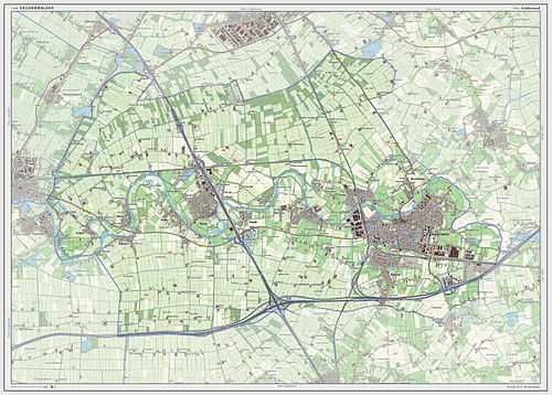
Dutch Topographic map of the municipality of Geldermalsen, 2013.
Demographics
Demographics of Geldermalsen, 2010:
Gallery
-
The road bridge between Buurmalsen and Geldermalsen
-

Linge river
-

Windmill in Geldermalsen
-

Tower of the Reformed Church in the center of Geldermalsen
-

Choir of the Reformed Church
-
The villa was built in 1929 by architect A. H. Wegerif
References
External links
| Wikimedia Commons has media related to Geldermalsen. |
 |
Culemborg | Buren |  | |
| Leerdam (ZH) | |
Tiel | ||
| ||||
| | ||||
| Lingewaal | Neerijnen |


