Gardon
| Gardon | |
|---|---|
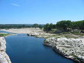
 The Gardon near the Pont du Gard | |
| Origin | Cévennes |
| Mouth |
Rhône 43°51′6″N 4°36′54″E / 43.85167°N 4.61500°ECoordinates: 43°51′6″N 4°36′54″E / 43.85167°N 4.61500°E |
| Basin countries | France |
| Length | 133 km |
| Avg. discharge | 32 m³/s |
| Basin area | 2,200 km² |


The Gardon or Gard (Occitan and French: Gardon, Gard) is a river in southern France. It is the namesake of the Gard département. Several of its tributaries are also called Gardon.
The Gardon is 133 km long including its longest tributary "Gardon de Saint-Jean". It rises in the Cévennes range of mountains and ends into the Rhône River (right-side tributary) at Comps, north of Beaucaire, across from Vallabrègues.
Features
The Roman aqueduct Pont du Gard and the 16th-century Pont Saint-Nicolas are two historic bridges that cross the Gardon. The Gorge du Gardon, which ends at Pont Saint-Nicolas, is a popular recreation area for kayaking, canoeing, rock climbing, and hiking.
The village of Collias, approximately 12 kilometers downriver from the Pont Saint-Nicolas, has several kayak and canoe rental agencies which will bus customers upriver to the Pont Saint-Nicolas (until the river level drops low in late June). Departing from Collias by kayak or canoe will bring you to the Pont du Gard in about an hour and one-half. It is possible to kayak or canoe under the Pont du Gard. Though, at times, the river is not high enough to allow for passage.
Floods
In September 2002 and again in December 2003, the Gardon had record level floods that damaged many of its bridges including the Pont Saint-Nicolas, which has since been fully restored. The river today shows few signs of the floods.
Places along the river
La Grand-Combe and Alès are situated on the "Gardon d'Alès", the major left tributary.
References
External links
- Regordane Info - The independent portal for the Regordane Way or St Gilles Trail. The Regordane Way runs alongside the Gardon River from Ners south-eastwards (English) (French)
| Wikimedia Commons has media related to Gardon. |