Garbsen
From Wikipedia, the free encyclopedia
| Garbsen | ||
|---|---|---|
 | ||
| ||
 Garbsen | ||
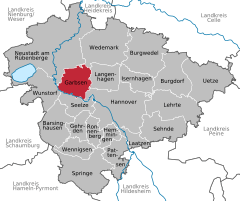
Location of Garbsen within Hanover district 
 | ||
| Coordinates: 52°25′06″N 09°35′53″E / 52.41833°N 9.59806°ECoordinates: 52°25′06″N 09°35′53″E / 52.41833°N 9.59806°E | ||
| Country | Germany | |
| State | Lower Saxony | |
| District | Hanover | |
| Subdivisions | 13 districts | |
| Government | ||
| • Mayor | Alexander Heuer (SPD) | |
| Area | ||
| • Total | 79.31 km2 (30.62 sq mi) | |
| Elevation | 50 m (160 ft) | |
| Population (2012-12-31)[1] | ||
| • Total | 59,516 | |
| • Density | 750/km2 (1,900/sq mi) | |
| Time zone | CET/CEST (UTC+1/+2) | |
| Postal codes | 30823, 30826, 30827 | |
| Dialling codes | 05131, 05137, 0511, 05031, 05032 | |
| Vehicle registration | H | |
| Website | www.garbsen.de | |
Garbsen is a town in the district of Hanover, in Lower Saxony, Germany. It is situated on the river Leine, approx. 11 km northwest of Hanover.
Division of the town
The town consists of 13[2] districts:
- Altgarbsen
- Auf der Horst
- Berenbostel
- Frielingen
- Garbsen-Mitte
- Havelse
- Heitlingen
- Horst
- Meyenfeld
- Osterwald Oberende
- Osterwald Unterende
- Schloss Ricklingen
- Stelingen
International relations
Garbsen is twinned with:
-
 Hérouville-Saint-Clair (France)
 -
 Rødding (Denmark)
 -
 Bassetlaw (United Kingdom)
 -
 Farmers Branch (Texas, USA)
 -
 Schönebeck (Elbe) (Saxony-Anhalt, Germany)
 -
 Września (Poland)
People of Garbsen
- Volker Finke, *March 24, 1948 - former football coach of SC Freiburg
- Frank Pagelsdorf, *February 5, 1958 - football coach of Hansa Rostock
- Erdoğan Atalay, *September 22, 1966 - Actor in Alarm für Cobra 11 – Die Autobahnpolizei
See also
- Metropolitan region Hannover-Braunschweig-Göttingen-Wolfsburg
References
External links
| Wikimedia Commons has media related to Garbsen. |
| |||||||
This article is issued from Wikipedia. The text is available under the Creative Commons Attribution/Share Alike; additional terms may apply for the media files.
