Gambolò
From Wikipedia, the free encyclopedia
| Gambolò | ||
|---|---|---|
| Comune | ||
| Comune di Gambolò | ||
 | ||
| ||
 Gambolò | ||
| Coordinates: 45°15′N 8°52′E / 45.250°N 8.867°E | ||
| Country | Italy | |
| Region | Lombardy | |
| Province | Pavia (PV) | |
| Frazioni | Belcreda, Garbana, Remondò, Stradella | |
| Government | ||
| • Mayor | Elena Nai | |
| Area | ||
| • Total | 51.5 km2 (19.9 sq mi) | |
| Elevation | 104 m (341 ft) | |
| Population (31 December 2010[1]) | ||
| • Total | 10,259 | |
| • Density | 200/km2 (520/sq mi) | |
| Demonym | Gambolesi or Gambolini | |
| Time zone | CET (UTC+1) | |
| • Summer (DST) | CEST (UTC+2) | |
| Postal code | 27025 | |
| Dialing code | 0381 | |
Gambolò is a comune (municipality) in the Province of Pavia in the Italian region Lombardy, located about 35 kilometres (22 miles) southwest of Milan and about 25 km (16 mi) northwest of Pavia.
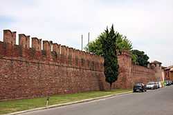
Gambolò borders the following municipalities: Borgo San Siro, Mortara, Tromello, Vigevano. Sights include the Litta Castle, the parish church of Sts. Eusebius and Gaudentius (in neo-medieval style) and the Pieve of Sant'Eusebio
Twin towns
References
This article is issued from Wikipedia. The text is available under the Creative Commons Attribution/Share Alike; additional terms may apply for the media files.