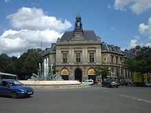
Gambetta (Paris Métro)
| Gambetta | |||||||||||||
|---|---|---|---|---|---|---|---|---|---|---|---|---|---|
 | |||||||||||||
| Date opened | 25 January 1905 | ||||||||||||
| Accesses |
Av. du Père Lachaise × rue des Pyrénées Rue Belgrand × av. Gambetta Rue des Pyrénées × av. Gambetta Pl. Martin Nadaud × av. Gambetta 4, pl. Martin Nadaud | ||||||||||||
| Municipality/ Arrondissement | the 20th arrondissement of Paris | ||||||||||||
| Fare zone | 1 | ||||||||||||
| Next stations | |||||||||||||
| |||||||||||||
| List of stations of the Paris Métro | |||||||||||||

Location of metro station | |||||||||||||

Gambetta is a station of the Paris Métro. It serves Line 3 and is the southern terminus of Line 3bis. It was opened on 25 January 1905 when the line was extended from Père Lachaise and was the eastern terminus of the line until 27 November 1921, when the line was extended to Porte des Lilas. In 1969, the former Martin Nadaud station—which was only 232 metres west of Gambetta—was combined with Gambetta by linking Martin Nadaud's closed platforms with Gambetta by tunnel. On 23 March 1971 the line to Porte des Lilas was separated from line 3 and became Line 3bis. The beginning of the old tunnel to Porte des Lilas now connects the platforms of lines 3 and 3bis. On 2 April 1971 line 3 was extended to Gallieni.
The station is in the Avenue Gambetta, which is named after the statesman Léon Gambetta (1838–82), Prime Minister for 66 days in 1881 and 1882.
Station layout
| Street Level |
| B1 | Mezzanine |
| Line 3 platforms | ||
| Westbound | ← | |
| Eastbound | → | |
| Line 3bis platforms | Northbound | → |
| Northbound | → | |
Gallery
-

Line 3 platforms at Gambetta
-

MF 67 rolling stock on Line 3 at Gambetta
-

Line 3bis platforms at Gambetta
-

Line 3bis platforms at Gambetta
| Wikimedia Commons has media related to Gambetta (Paris Metro). |
References
- Roland, Gérard (2003). Stations de métro. D’Abbesses à Wagram. Éditions Bonneton.
| Paris Métro | Line 3bis | |
|---|---|---|
Coordinates: 48°51′54″N 2°23′54″E / 48.864947°N 2.398451°E