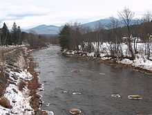
Gale River
Coordinates: 44°15′24″N 71°49′52″W / 44.2567°N 71.8312°W

The Gale River is a 13.1 mile long (21.1 km)[1] tributary of the Ammonoosuc River in northwestern New Hampshire in the United States. Via the Ammonoosuc, it is part of the watershed of the Connecticut River, which flows to Long Island Sound.
The Gale River flows for its entire length in Grafton County. It rises in the White Mountains in the town of Franconia as two short, northward-flowing streams: its North Branch and its South Branch. The two streams join in Bethlehem, and the Gale River flows thence generally westwardly. Returning to Franconia, the river collects the Ham Branch, its most significant tributary, then passes through Sugar Hill to Lisbon, where it joins the Ammonoosuc River.[2]
See also
- List of New Hampshire rivers
References
- ↑ New Hampshire GRANIT state geographic information system
- ↑ DeLorme (1999). New Hampshire Atlas & Gazetteer. Yarmouth, Maine: DeLorme. ISBN 0-89933-242-0
External links
- U.S. Geological Survey Geographic Names Information System: Gale River
- U.S. Geological Survey Geographic Names Information System: North Branch Gale River
- U.S. Geological Survey Geographic Names Information System: South Branch Gale River