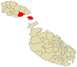
Għajnsielem, meaning "Peaceful Spring", is a municipality on the southeastern coast of the island of Gozo in Malta, including the entire island of Comino. It has a population of 3,260 residents as of March 2011,[1] and is the first Gozitan village that greets the visitor on leaving Mġarr Harbour towards the Gozitan heartland. Its name originated from the water spring, around which in 1700, Grandmaster Perellos built an arcade containing public washbasins and fresh water spouts. Attractions include Lourdes Chapel with its sharp steeple and underlying niche of Our Lady of Lourdes, Fort Chambray and the towering of Ghajnsielem Parish Church.
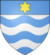
Village Motto and Coat of Arms
The Latin motto of Ghajnsielem is Ob fontem prosperitas, that is Flourishing because of a spring – Nistaghna b’nixxiegha ilma. The springs in the area were the magnet that attracted the first inhabitants that eventually led to the prosperity of the place.
Places of interest
Band Clubs
Football Clubs
Zones in Għajnsielem
- Borġ l-Għarib
- Fort Chambray
- Ġnien Miġiaro
- Iċ-Ċens
- Il-Gudja
- Mġarr Port
- Mġarr Valley
- Mrejżbiet
- Rdum it-Tafal
- Ta' Briegħen
- Ta' Cordina
- Ta' Kusbejja
- Taħt il-Belt
- Tal-Palma
- Xatt l-Aħmar
- Żewwieqa
Għajnsielem Main Roads
- Pjazza Indipendenza (Independence Square)
- Pjazza Loreto (Loreto Square)
- Triq Borġ Għarib (Borg Gharib Road)
- Triq il-Fawwara
- Triq il-Ġnien (Garden Street)
- Triq il-Ħamri
- Triq il-Qala (Qala Road)
- Triq in-Nadur (Nadur Road)
- Triq ix-Xatt (Strand Street)
- Triq iż-Żewwieqa
- Triq l-Imġarr (Mġarr Road)
- Triq Sant' Antnin (St Anthony Road)
See also
References
External links


