Göksu Dam
From Wikipedia, the free encyclopedia
| Göksu Dam | |
|---|---|
 | |
| Official name | Göksu Baraji |
| Location | Diyarbakır, Turkey |
| Coordinates | 37°41′01.68″N 40°26′41.64″E / 37.6838000°N 40.4449000°ECoordinates: 37°41′01.68″N 40°26′41.64″E / 37.6838000°N 40.4449000°E |
| Purpose | Irrigation |
| Status | Operational |
| Construction began | 1987 |
| Opening date | 1991 |
| Owner(s) | State Hydraulic Works |
| Dam and spillways | |
| Type of dam | Embankment, rock-fill |
| Impounds | Göksu Stream |
| Length | 674 m (2,211 ft) |
| Height | 52 m (171 ft) |
| Elevation at crest | 702 m (2,303 ft) |
| Width (crest) | 10 m (33 ft) |
| Width (base) | 226 m (741 ft) |
| Dam volume | 1,900,000 m3 (1,540 acre·ft) |
| Spillway type | Service overflow, uncontrolled |
| Spillway capacity | 2,150 m3/s (75,927 cu ft/s) |
| Reservoir | |
| Creates | Göksu Reservoir |
| Total capacity | 56,000,000 m3 (45,000 acre·ft) |
| Active capacity | 44,000,000 m3 (36,000 acre·ft) |
| Inactive capacity | 12,000,000 m3 (9,700 acre·ft) |
| Catchment area | 672 km2 (259 sq mi) |
| Surface area | 4.2 km2 (1.6 sq mi)[1] |
| Normal elevation | 700 m (2,300 ft) |
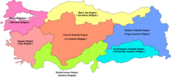
Göksu Dam is a dam on Göksu Stream south of Diyarbakır city in Turkey. Constructed between 1987 and 1991, the development was backed by the Turkish State Hydraulic Works. The primary purpose of the dam is irrigation and it supplies water to 3,582 ha (8,850 acres).
See also
References
- ↑ "Ilisu Dam Environmental Impact Assessment". State Hydraulic Works. 2005. pp. TABLE 2–5 (PDF pgs. 116–117). Retrieved 21 May 2013.
- Göksu Dam, State Hydraulic Works (Turkey), Retrieved December 16, 2009
This article is issued from Wikipedia. The text is available under the Creative Commons Attribution/Share Alike; additional terms may apply for the media files.
