Fujinomiya Station
Fujinomiya Station 富士宮駅 | |
 | |
|---|---|
| JR Fujinomiya Station | |
| Location | |
| Prefecture | Shizuoka (See other stations in Shizuoka) |
| City | Fujinomiya |
| Neighborhood etc. | 16 Chuo-machi |
| Postal code | 418-0065 |
| (in Japanese) | 静岡県富士宮市中央町16 |
| History | |
| Year opened | 1913 |
| Rail services | |
| Operator(s) | JR Central |
| Line(s) | Minobu Line |
| Statistics | 2444 passengers/day 2006 |
Fujinomiya Station (富士宮駅 Fujinomiya-eki) is a railway station on the Minobu Line of Central Japan Railway Company (JR Central) located in Fujinomiya, Shizuoka Prefecture, Japan. It is approximately at the mid-way point of the Minobu Line within Shizuoka Prefecture.

Lines
Station layout
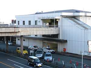
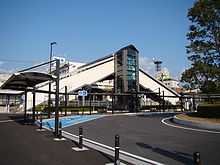
Fujinomiya Station consists of a single side platform serving Track 1, which is an auxiliary platform used primarily for chartered trains by the Soka Gakkai organization, and a single island platform for Track 2 and Track 3, which handle regularly scheduled services. The station building is built on the overpasses connecting the platforms, and has automated ticket machines, automated turnstiles and a manned service counter.
Platforms
| 2 | ■Minobu Line | For Fuji, Shizuoka |
| 3 | ■Minobu Line | For Nishi-Fujinomiya, Minobu, Kōfu |
Adjacent stations
| « | Service | » | ||
|---|---|---|---|---|
| Central Japan Railway Company | ||||
| Minobu Line | ||||
| Gendōji | - | Nishi-Fujinomiya | ||
History
Fujinomiya Station was opened on July 20, 1913 as part of the original Minobu Line under the name of Omiya Station (大宮駅 Omiya-eki). It came under control of the Japan National Railway on May 1, 1941 and on October 1, 1942 its name was changed to the present name. The station building was rebuilt in 1983. Regularly scheduled freight service was discontinued from 1984. Along with the division and privatization of JNR on April 1, 1987, the station came under the control and operation of the Central Japan Railway Company. The station was remodeled in 2007 to allow for barrier free access.
External links
![]() Media related to Fujinomiya Station at Wikimedia Commons
Media related to Fujinomiya Station at Wikimedia Commons
Coordinates: 35°13′17″N 138°36′55″E / 35.22139°N 138.61528°E