French Pete Trail
| French Pete Trail | |
|---|---|
 Map of French Pete area and surroundings | |
| Length | 9.8 mi (15.8 km) |
| Location | Cascade Range, Lane County, Oregon |
| Designation | Three Sisters Wilderness |
| Use | Hikers, horses |
| Hiking details | |
| Trail difficulty | Easy to Moderate |
| Season | Late March to mid-December |
| Months | About 9 |
| Sights | French Pete Creek, old-growth forest |
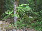
The French Pete Trail is a 9.8-mile (15.8 km) forest hiking trail in the valley of French Pete Creek in the Three Sisters Wilderness of western Oregon.[1][2] The trail goes through old-growth forest that was the subject of nationwide political debate in the 1970s regarding proposed wilderness designation. In 1978, the U.S. Congress added the area to the Three Sisters Wilderness.
Description
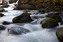
The trail is in an old-growth forest in the Three Sisters Wilderness of the Willamette National Forest.[3] At the trailhead, the elevation is 1,850 feet (560 m). Open to hikers and horses spring through fall, the trail gains about 950 feet (290 m) after 5 miles (8.0 km) and ends after 9.8 miles (15.8 km). French Pete Creek flows beside the trail for 3 miles (4.8 km).[4][5] The forest is made of "gargantuan Douglas firs and 1000-year-old cedars."[4]
History

The passage of the Wilderness Act in 1964 created new wilderness areas and controversy over the management for the new areas. This also marked the establishment and growth of an activist environmental movement. The movement is best known for the controversy surrounding French Pete's addition to the wilderness area.[6]
In 1957, the Secretary of Agriculture lifted French Pete from protection.[7] Debate on whether to once again protect French Pete's 19,200 acres (78 km2) from logging started in the mid-1960s, but legislation for it was not introduced until 1974. The controversy continued until 1978, when the Three Sisters Wilderness was expanded to include the French Pete area.
It was in 1968 that logging plans in the valley were announced. Most local citizens were opposed to these plans, and the Save French Pete Committee was founded. The group appealed the logging proposal in court, but the appeal was rejected, and instead the logging was only delayed,[8][9][10] adding to political tensions.[8]

The U.S. Forest Service had a tradition of encouraging logging in the forests of western Oregon. It planned to log at least 3,000,000 board feet (7,100 m3) of timber if the area was not protected to ensure that the logging industry would be able "to survive the mounting demands from preservationists to stop logging scenic areas."[11][12] There was also concern that without logging, there would be a heightened risk of wildfire, because many of the area's trees were diseased or had been infested and killed by beetles. A forester from Springfield said, "It will be a very short time until the happenstance of lightning once again starts a fire that will wipe out the countryside."[13]
In 1972, U.S. Senator Wayne Morse, Democrat of Oregon, hiked into the area with environmental activists and encouraged the Republican senator who had defeated him in the past election, Mark Hatfield, to do the same. After his hike, Morse expressed confidence that the area would be protected, whereas Hatfield still supported some logging.[14] However, Hatfield later changed his mind and began to support wilderness designation in general.[15]
Finally, in 1978, 45,400 acres (18,400 ha) of the French Pete forest were designated as wilderness by the Endangered Wilderness Act, which took effect on 28 February.[16][17] French Pete became the first low-elevation valley in the Three Sisters Wilderness, after "14 years of ardent protest by hikers, students, and environmentalists."[9][4]
References
- ↑ "French Pete Campground". Willamette National Forest. Retrieved 6 August 2010.
- ↑ "French Pete Campground". Travel Oregon. Retrieved 13 August 2010.
- ↑ "French Pete Creek". Trails.Com. Retrieved 7 August 2010.
- ↑ 4.0 4.1 4.2 Sullivan, William L. 100 hikes in the central Oregon Cascades (2004 ed.). Eugene, Oregon: Navillus Press. pp. 158–159. ISBN 0-9618152-6-4.
- ↑ "French Pete Trail". Gorp.Com. Retrieved 13 August 2010.
- ↑ "A brief history of the Willamette National Forest" (24 October 2003). Willamette National Forest. Retrieved 12 September 2010. This article incorporates text from this source, which is in the public domain.
- ↑ Hughes, J. Donald (2009). An Environmental History of the World. New York: Routledge. p. 204. ISBN 0-415-13619-9.
- ↑ 8.0 8.1 Williams, Gerald W. (2007). The Forest Service: Fighting for Public Lands. Westport, Connecticut: Greenwood Press. p. 181. ISBN 0-313-33794-2.
- ↑ 9.0 9.1 Marsh, Kevin. "Three Sisters Wilderness". The Oregon Encyclopedia. Portland State University. Retrieved 12 August 2010.
- ↑ Wuerthner, George (2002). 's+Wilderness+Areas:+The+Complete+Guide#v=onepage&q&f=false Oregon's Wilderness Areas: the Complete Guide. Englewood, Colorado: Westcliffe Publishers. p. 20. ISBN 1-56579-434-6.
- ↑ Smith, A. Robert (26 May 1972). "Hatfield to visit French Pete, then reveal stance". The Register-Guard (Eugene, Oregon). p. C1. Retrieved 5 March 2011.
- ↑ Marsh, Kevin R. (2007). Drawing Lines in the Forest. Seattle: University of Washington Press. p. 133. ISBN 0-295-98702-2.
- ↑ Paseman, Lloyd (18 November 1971). "French Pete Valley facing threat of fire, forester says". The Register-Guard. p. B1. Retrieved 17 October 2010.
- ↑ Willis, Henny (15 August 1972). "Morse pledges to fight for bill to preserve French Pete area". The Register-Guard. p. 6B. Retrieved 8 August 2010.
- ↑ Kerr, Andy (2004). Oregon Wild: Endangered Forest Wilderness. Portland, Oregon: Oregon Natural Resources Council. p. 57. ISBN 0-9624877-8-3.
- ↑ Associated Press (24 January 1978). "Wilderness dispute resolved". The Bulletin (Bend, Oregon). p. 11. Retrieved 19 October 2010.
- ↑ McArthur, Lewis A.; McArthur, Lewis L. (2003) [First published 1928]. Oregon Geographic Names (7th ed.). Portland, Oregon: Oregon Historical Society Press. p. 384. ISBN 9780875952772. OCLC 53075956.
External links
- Photo of French Pete Creek by Andrew Kumler
- French Pete Trail # 3311 from the Willamette National Forest
Coordinates: 44°02′28″N 122°12′27″W / 44.04111°N 122.20750°W