Frankenberg, Saxony
From Wikipedia, the free encyclopedia
| Frankenberg | ||
|---|---|---|
 | ||
| ||
 Frankenberg | ||
Location of Frankenberg within Mittelsachsen district 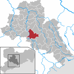 | ||
| Coordinates: 50°54′39″N 13°2′16″E / 50.91083°N 13.03778°ECoordinates: 50°54′39″N 13°2′16″E / 50.91083°N 13.03778°E | ||
| Country | Germany | |
| State | Saxony | |
| District | Mittelsachsen | |
| Government | ||
| • Mayor | Thomas Firmenich (CDU) | |
| Area | ||
| • Total | 65.42 km2 (25.26 sq mi) | |
| Elevation | 262 m (860 ft) | |
| Population (2012-12-31)[1] | ||
| • Total | 14,676 | |
| • Density | 220/km2 (580/sq mi) | |
| Time zone | CET/CEST (UTC+1/+2) | |
| Postal codes | 09669 | |
| Dialling codes | 037206 | |
| Vehicle registration | FG | |
| Website | www.frankenberg-sachsen.de | |

Frankenberg (also: Frankenberg/Sa.) is a town in the district of Mittelsachsen, in the Free State of Saxony, Germany. It is situated on the river Zschopau, 12 km (7.46 mi) northeast of Chemnitz.
It was the site of the Nazi concentration camp Sachsenburg.
| Wikimedia Commons has media related to Frankenberg/Sa.. |
References
- ↑ "Statistisches Landesamt des Freistaates Sachsen – Bevölkerung des Freistaates Sachsen jeweils am Monatsende ausgewählter Berichtsmonate nach Gemeinden". Statistisches Landesamt des Freistaates Sachsen (in German). 17 June 2013.
This article is issued from Wikipedia. The text is available under the Creative Commons Attribution/Share Alike; additional terms may apply for the media files.