Ferndorf
From Wikipedia, the free encyclopedia
| Ferndorf | ||
|---|---|---|
| ||
 Ferndorf | ||
| Coordinates: 46°44′N 13°38′E / 46.733°N 13.633°ECoordinates: 46°44′N 13°38′E / 46.733°N 13.633°E | ||
| Country | Austria | |
| State | Carinthia | |
| District | Villach-Land | |
| Government | ||
| • Mayor | Andreas Staber (SPÖ) | |
| Area | ||
| • Total | 31.41 km2 (12.13 sq mi) | |
| Elevation | 560 m (1,840 ft) | |
| Population (1 January 2013)[1] | ||
| • Total | 2,249 | |
| • Density | 72/km2 (190/sq mi) | |
| Time zone | CET (UTC+1) | |
| • Summer (DST) | CEST (UTC+2) | |
| Postal code | 9702 | |
| Area code | 04245 | |
| Website | www.ferndorf.at | |
Ferndorf (Slovene: Perja vas ) is a municipality in the district of Villach-Land in the Austrian state of Carinthia.
Geography
The municipal area stretches from the Drava Valley up to a smaller range of the Nock Mountains between and the southern shore of Millstätter See. It comprises the cadastral communities of Ferndorf and Gschriet, made up of several hamlets.
Neighbouring municipalities
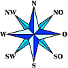
| Millstatt | Radenthein | |
| Spittal an der Drau |  |
Feld am See |
| Stockenboi | Paternion | Fresach |
History
Ferndorf was first mentioned as Vedendorf in a 1391 deed. From 1865 to 1906 it was part of the Paternion market town. Original an agraric area the population today largely depends on the magnesite works in nearby Radenthein.
Twin town
Ferndorf is twinned with:
References
| |||||
This article is issued from Wikipedia. The text is available under the Creative Commons Attribution/Share Alike; additional terms may apply for the media files.
