Feijenoord district
From Wikipedia, the free encyclopedia
For the football team, see Feyenoord.
For the football stadium, see De Kuip.
| Feijenoord | |
|---|---|
.JPG) | |
 | |
| Country |
|
| Province | South Holland |
| COROP | Rotterdam |
| Time zone | CET (UTC+1) |
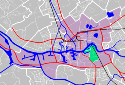
Feijenoord (Dutch pronunciation: [ˈfɛ.jə.ˌnɔːrt]) is a district in Rotterdam and is located south of the Nieuwe Maas. As of 1 January 2004 there were 72,320 citizens. The area is 6.44 km² (1.45 km² of this is water). It is not the home of the city's main football club, Feyenoord, which is situated in the neighbouring township of IJsselmonde.
The district gained significance in the 19th century as a centre of shipbuilding, principally at the Feijenoord yard.
External links
| |||||||
Coordinates: 51°53′46″N 4°30′50″E / 51.896°N 4.514°E
This article is issued from Wikipedia. The text is available under the Creative Commons Attribution/Share Alike; additional terms may apply for the media files.