Farmersville, California
| Farmersville, California | |
|---|---|
| City | |
| Motto: "The world is quiet here" | |
 | |
| Coordinates: 36°18′4″N 119°12′27″W / 36.30111°N 119.20750°WCoordinates: 36°18′4″N 119°12′27″W / 36.30111°N 119.20750°W | |
| Country |
|
| State |
|
| County | Tulare |
| Area[1] | |
| • Total | 2.258 sq mi (5.849 km2) |
| • Land | 2.258 sq mi (5.849 km2) |
| • Water | 0 sq mi (0 km2) 0% |
| Elevation | 358 ft (109 m) |
| Population (2010) | |
| • Total | 10,588 |
| • Density | 4,700/sq mi (1,800/km2) |
| Time zone | Pacific (PST) (UTC-8) |
| • Summer (DST) | PDT (UTC-7) |
| ZIP code | 93223 |
| Area code(s) | 559 |
| FIPS code | 06-23616 |
| GNIS feature ID | 1652709 |
Farmersville is a city in Tulare County, California, United States, just to the east of Visalia, California. The population was 10,588 at the 2010 census, up from 8,737 at the 2000 census.
Geography
Farmersville is located at 36°18′4″N 119°12′27″W / 36.30111°N 119.20750°W (36.301169, -119.207603).[2]
According to the United States Census Bureau, the city has a total area of 2.3 square miles (6.0 km2), all of it land.
Demographics
2010
The 2010 United States Census[3] reported that Farmersville had a population of 10,588. The population density was 4,688.2 people per square mile (1,810.1/km²). The racial makeup of Farmersville was 5,295 (50.0%) White, 60 (0.6%) African American, 213 (2.0%) Native American, 72 (0.7%) Asian, 5 (0.0%) Pacific Islander, 4,494 (42.4%) from other races, and 449 (4.2%) from two or more races. Hispanic or Latino of any race were 8,876 persons (83.8%).
The Census reported that 10,588 people (100% of the population) lived in households, 0 (0%) lived in non-institutionalized group quarters, and 0 (0%) were institutionalized.
There were 2,595 households, out of which 1,639 (63.2%) had children under the age of 18 living in them, 1,474 (56.8%) were opposite-sex married couples living together, 515 (19.8%) had a female householder with no husband present, 274 (10.6%) had a male householder with no wife present. There were 257 (9.9%) unmarried opposite-sex partnerships, and 10 (0.4%) same-sex married couples or partnerships. 258 households (9.9%) were made up of individuals and 110 (4.2%) had someone living alone who was 65 years of age or older. The average household size was 4.08. There were 2,263 families (87.2% of all households); the average family size was 4.28.
The population was spread out with 3,895 people (36.8%) under the age of 18, 1,234 people (11.7%) aged 18 to 24, 2,941 people (27.8%) aged 25 to 44, 1,822 people (17.2%) aged 45 to 64, and 696 people (6.6%) who were 65 years of age or older. The median age was 26.2 years. For every 100 females there were 101.5 males. For every 100 females age 18 and over, there were 100.4 males.
There were 2,726 housing units at an average density of 1,207.0 per square mile (466.0/km²), of which 1,590 (61.3%) were owner-occupied, and 1,005 (38.7%) were occupied by renters. The homeowner vacancy rate was 2.5%; the rental vacancy rate was 4.2%. 6,537 people (61.7% of the population) lived in owner-occupied housing units and 4,051 people (38.3%) lived in rental housing units.
2000
As of the census[4] of 2000, there were 8,737 people, 2,151 households, and 1,854 families residing in the city. The population density was 4,655.2 people per square mile (1,794.3/km²). There were 2,269 housing units at an average density of 1,209.0 per square mile (466.0/km²). The racial makeup of the city was 42.36% White, 0.40% African American, 1.76% Native American, 1.14% Asian, 0.03% Pacific Islander, 48.35% from other races, and 5.95% from two or more races. Hispanic or Latino of any race were 72.02% of the population.
There were 2,151 households out of which 54.8% had children under the age of 18 living with them, 61.8% were married couples living together, 16.6% had a female householder with no husband present, and 13.8% were non-families. 10.6% of all households were made up of individuals and 5.3% had someone living alone who was 65 years of age or older. The average household size was 4.05 and the average family size was 4.32.
In the city the population was spread out with 38.4% under the age of 18, 12.7% from 18 to 24, 27.9% from 25 to 44, 14.7% from 45 to 64, and 6.3% who were 65 years of age or older. The median age was 24 years. For every 100 females there were 102.8 males. For every 100 females age 18 and over, there were 102.9 males.
The median income for a household in the city was $27,682, and the median income for a family was $29,629. Males had a median income of $23,680 versus $20,699 for females. The per capita income for the city was $8,624. About 23.6% of families and 30.7% of the population were below the poverty line, including 37.3% of those under age 18 and 22.3% of those age 65 or over.
Politics
The mayor of Farmersville is Leonel Benavides. Mr. Benavides is also a pastor of Bethel Spanish Assembly of God. The Mayor pro-tem is Greg Gomez. Mr Gomez is a database administrator for the County of Tulare and has been employed there for 18 years. Don Rowlett is also on the council. He is a teacher and works at George L. Snowden School. Farmersvile also allows one student over the age of 13 to be part of the council. In the state legislature Farmersville is located in the 16th Senate District, represented by Democrat Michael Rubio, and in the 34th Assembly District, represented by Republican Connie Conway. Federally, Farmersville is located in California's 21st congressional district, which has a Cook PVI of R +13[5] and is represented by Republican Devin Nunes.
Economics
The economy of Farmersville is heavily dependent on agriculture. Much of the population is employed as agricultural workers. Local commerce is composed of mostly small family-owned businesses, with a high concentration of fast food and used automobiles. Farmersville boasts a McDonalds, a Jack-in-the-Box, and a Subway sandwich shop as well as other local venues. Other large chain retailers include an AutoZone store, and a Dollar Tree store.There is also a plan to bring a FAMILY DOLLAR to the town. Atlas Walnut company will also be opening a walnut processing facility in the near future. The city also boasts three bakeries.
Education
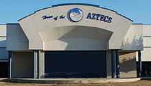
Farmersville has a single unified school district with Farmersville High School (the Aztecs), a middle school, and 3 elementary schools. J.E. Hester school is an elementary school with the grades of K-1st. George L. Snowden has 2nd and 3rd graders. The newest school is Freedom Elementary which consists of 4th and 5th graders. The Junior High has 6th through 8th graders. The High School has 9th through 12th grade. Farmersville will be building a new middle school east of Freedom School in the future.
History
The first history of the Farmersville area was in the 1850s. There was a community developed called Deep Creek. It is located near the present Deep Creek Cemetery and there are headstones that date back to the 1850s. There was a school built there to accommodate the farm children in the area. The Fly family history, which is preserved in a book written about their travels to California, there is talk about attending the Deep Creek School in the 1860s.
Until 1863, many of the residents living on the east side of the county traveled Visalia Road by wagon to get their mail, purchase supplies and bring their goods to sell. The trip was so long that many would stop at the Wiley Hinds farm, just south of present day Farmersville, to ask to sleep in their barn and continue their trip home the next day.
Wiley Hinds was a former slave, his brother Archibald, came from Arkansas in 1858. He settled in Farmersville, purchased other parcels for farming and was very prosperous.
In approximately 1865, two entrepreneurs, Crowley and Jasper, decided to capture the sales of residents on the east side of the county on their way to Visalia to get their mail. Unfortunately, they were not successful. In 1868, T.J. Brundage purchased the business and applied for a post office status. This was the trick needed to get the eastern residents to stop in Farmersville.
Brundage also had a lumber yard across the street from the general store. Oxen would pull the lumber shipment from the Sierra mills.
Just east of the Brundage General Store was the Brown Hotel. It was built in 1870 by Edward Balaam and purchased by Charles Brown. The hotel was two stories and a popular stop over by those needing a rest from the Overland Stage trip that would stop at the livery stable, owned by Brown, to change horses.
Farmersville's first school house was built at the southwest corner of the Four Corners. It was a two story building with the classrooms on the first floor, and a community room on the second for meetings and dances in 1869. It was torn down and a new school was built at the present day Snowden Elementary site. That schoolhouse was replaced in 1951.
The discussion to incorporate started as early as 1945. However, Don Freeman began the petition and application process that ended on October 6, 1960, in the City's incorporation. The first council was; James Tornow, Mayor, Truman Qualls, Don Freeman, Willis Freeman, Jim Steven and council members. Carl Waddle was the first City Clerk. The City struggled to get proper water delivery and wastewater treatment. It was in 1968 that the Wastewater treatment plant loan was made for $480,000 to build the first plant and transmission infrastructure. The City was discussing disincorporation by the late 1960s.
The City had already voted in 1945 to pay for its own police department so the City already had public safety.
Farmersville Methodist Church
Built in the 1880s, the chapel of the former Farmersville Methodist Church was rolled to Farmersville on logs, with horses pulling it, in approximately 1902. It was established on Farmersville Blvd. just south of Visalia Road, also known as the “four Corners” around 1947; a Mrs. Avery donated a parcel of her land that is now Avery and Ash. The chapel portion of the church was moved again, to that location. The steeple broke during this move. It was rebuilt with the fishtail shingles.
References
- ↑ U.S. Census
- ↑ "US Gazetteer files: 2010, 2000, and 1990". United States Census Bureau. 2011-02-12. Retrieved 2011-04-23.
- ↑ All data are derived from the United States Census Bureau reports from the 2010 United States Census, and are accessible on-line here. The data on unmarried partnerships and same-sex married couples are from the Census report DEC_10_SF1_PCT15. All other housing and population data are from Census report DEC_10_DP_DPDP1. Both reports are viewable online or downloadable in a zip file containing a comma-delimited data file. The area data, from which densities are calculated, are available on-line here. Percentage totals may not add to 100% due to rounding. The Census Bureau defines families as a household containing one or more people related to the householder by birth, opposite-sex marriage, or adoption. People living in group quarters are tabulated by the Census Bureau as neither owners nor renters. For further details, see the text files accompanying the data files containing the Census reports mentioned above.
- ↑ "American FactFinder". United States Census Bureau. Retrieved 2008-01-31.
- ↑ "Will Gerrymandered Districts Stem the Wave of Voter Unrest?". Campaign Legal Center Blog. Retrieved 2008-02-10.
