Fanling
| Fanling | |||||||||||
 | |||||||||||
| Simplified Chinese | 粉岭 | ||||||||||
|---|---|---|---|---|---|---|---|---|---|---|---|
| Traditional Chinese | 粉嶺 | ||||||||||
| |||||||||||


Fanling /ˌfænˈlɪŋ/, also known as Fan Ling and Fan Leng, is an area in the New Territories of Hong Kong香港. Administratively, it is part of the North District. Fanling Town, part of the Fanling area, is where most of population of the area live.
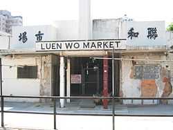
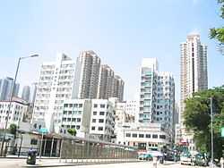
Part of Fanling-Sheung Shui New Town, Fanling Town includes Luen Wo Hui (聯和墟), the marketplace of Fanling before urban development in the area, and Wo Hop Shek (和合石), where an uphill public cemetery is located. The population of Fanling keeps growing. Today many public and private estates can be found in the area.
Northwest of Fanling is Sheung Shui(上水) and southeast is Tai Po. The name Fanling is a shortened form of Fan Pik Leng (粉壁嶺). The enclosing walls and corner watch towers of Kun Lung Wai, Lung Yeuk Tau, is a declared monument of Hong Kong.
Fanling North is one of three new development areas currently being planned for North District, in parallel with Ta Kwu Ling and Kwu Tung North.[1]
Sights
- Fanling Wai (粉嶺圍), a walled village.
- Fung Ying Seen Koon (蓬瀛仙館), a Taoist temple.
- Siu Hang Tsuen (小坑村), an ancient village.
- Tao Heung Foods of Mankind Museum
- Lung Yeuk Tau Heritage Trail
Public and private housing estates in Fanling Town
- Avon Park (碧湖花園)
- Belaire Monte (綠悠軒)
- Cheung Wah Estate (祥華邨)
- Dawning Views (牽晴間)
- Fanling Centre (粉嶺中心)
- Flora Plaza (花都廣場)
- Grand Regentville (御庭軒)
- Regentville (帝庭軒)
- Ka Fuk Estate (嘉福邨)
- Ka Shing Court (嘉盛苑)
- King Shing Court (景盛苑)
- Wah Ming Estate (華明邨)
- Wah Sum Estate (華心邨)
- Yan Shing Court (欣盛苑)
- Yung Shing Court (雍盛苑)
- Greenpark Villa (蔚翠花園)
- Cheerful Park (欣翠花園)
- Vienna Garden (維也納花園)
- Wing Fok Centre (榮福中心)
- Wing Fai Centre (榮輝中心)
- Union Plaza (海聯廣場)
- Fanling Town Centre (粉嶺名都)
Villages in the Fanling area
- Ma Wat Tsuen (麻笏村)
Transport
Fanling is served by:
- Route 9
- Fanling Station in Fanling Town
- Bus routes
See also
References
External links
| Wikimedia Commons has media related to Fanling. |
- Fanling Babies Home - Hong Kong orphanage - Children's Home
- Orthophoto of Fanling in Google Map
- About Lung Yeuk Tau (in Chinese only)
Coordinates: 22°29′30″N 114°08′29″E / 22.4918°N 114.1415°E