Faisalabad District
| Faisalabad District | |
|---|---|
| District | |
 (highlighted in orange) within Punjab | |
| Country | Pakistan |
| Province | Punjab |
| Capital | Faisalabad City |
| Government | |
| • Commissioner Faisalabad Division | Sardar Akram Javaid |
| • District Coordination Officer | Noor-ul-Amin Mengal |
| Population (2010)[1] | |
| • Total | 7,000,000 |
| Time zone | PST (UTC+5) |
| Number of Tehsils | 6 |
| Website | http://www.faisalabad.gov.pk/ |
Faisalabad District (Urdu: ضلع فیصل آباد) is one of the districts of Punjab province, Pakistan. According to the 1998 census of Pakistan it had a population of 5,429,547 of which almost 42% were in Faisalabad City. It is the third largest city of Pakistan after Karachi and Lahore.[2]
In 1982 Toba Tek Singh District (until then a tehsil of Faisalabad) was created as a separate district from Faisalabad. As of 2006 it is a city district consisting of the city of Faisalabad.
History
In 997 CE, Sultan Mahmud Ghaznavi, took over the Ghaznavid dynasty empire established by his father, Sultan Sebuktegin, In 1005 he conquered the Shahis in Kabul in 1005, and followed it by the conquests of Punjab region. The Delhi Sultanate and later Mughal Empire ruled the region. The Punjab region became predominantly Muslim due to missionary Sufi saints whose dargahs dot the landscape of Punjab. After the decline of the Mughal Empire, the Sikh invaded and occupied Faisalabad District. The Muslims faced severe restrictions during the Sikh rule. During the period of British rule, Faisalabad District increased in population and importance.
In 1870s the colonial era Punjab government decided to increase the cultivated land by making barrages and canals to meet the demand of European markets. This led to the canal based irrigation of the areas now comprising the district of Faisalabad and Toba Tek Singh. In 1880, a colonial officer, Captain Poham Young, with the support of Sir James Broadwood Lyall founded the new Town it was named Lyallpur after his Surname. proposed a new town. The design was based on the Union Jack, with eight roads radiating from a large clock tower in the center.
It was called the Chenab Bar after renamed as Lyallpur District, large numbers of Muslims from Lahore District, Rawalpindi District and Dera Ghazi Khan District migrated and settled in the newly irrigated areas. While some Sikhs from Eastern Punjab from Ludhiana District, Jalandhar District and Ambala District migrated to this new region where they established new villages naming them after their own villages which they left. Many villages Lyallpur District were named with prefix 'Chak'.
In 1903 it was decided to establish an agricultural college, the modern University of Agriculture. In 1904 the new district of Lyallpur was constituted, composed of the tehsils of Lyallpur, Samundri and Toba Tek Singh, with a subtehsil at Jaranwala which later became a full tehsil. By 1906, the district headquarters began to function in Lyallpur and all the bazaars and settlements within the bounds of a ring road were nearing completion. The city began to spread outside the circular road. The Town Committee was upgraded to a Municipal Committee in 1909 and the Deputy Commissioner was appointed as its first chairman. In 1916, the grain market saw its shops surging with customers. In the same year the civil hospital was expanded. With the advent of World War II, there was an increase in political awareness across the city. Revolutionary meetings were held, fiery speeches made, and slogans written on walls.[citation needed]
The first colonisation officer Raja Aurangzeb Khan made sure that no individual in this district owned more than 25 squares (625 acres (2.53 km2)) of land. The merit or method of allotting the land was to check each individual's hand who was applying for some land, and if the hands showed that individual had worked hard in the past, only then was land given to him, which has led to a district where there aren't any big land owners, as the land has been equally distributed amongst hard working men and it is their hard work that has led to Faisalabad becoming the third richest district in Pakistan.[citation needed]
In 1943, Quaid-e-Azam Mohammad Ali Jinnah visited the District and the City where he addressed a gathering of over 2 million in Dhobi Ghat Grounds.
The predominantly Muslim population supported Muslim League and Pakistan Movement. After the independence of Pakistan in 1947, the minority Hindus and Sikhs migrated to India while the Muslim refugees from India settled in the Faisalabad District.
In 1977, the name of the city and the District was changed to "Faisalabad" (City of Faisal), in honour of the late King Faisal of Saudi Arabia, who was held in high regard in Pakistan. In 1985, the district was upgraded to a division with the new districts of Faisalabad, Jhang and Toba Tek Singh.
The main Muslim Jat tribes and clans are Bajwa, Kahlon, Cheema, Waraich, Randhawa, Bandechha , Chatha, beniwal (vehniwal), Kharal, Naul, Sipra, Sial, Langrial, Bains etc. With other Main Muslim tribes are Arain and Awan clans in this district.
Language
Main Language of the people is Punjabi while Urdu is also spoken.
Administration
Until divisions were abolished in the year 2000 it was part of Faisalabad Division.
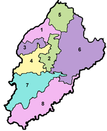
The district is currently subdivided into six tehsils:[3]
- Faisalabad
- Faisalabad Saddar Tehsil
- Jaranwala Tehsil
- Jhumra
- Samundri Tehsil
- Tandlianwala Tehsil
See also
- List of Bari Tribes
- Chak No.65-GB Mukandpur, Jaranwala, District Faisalabad, Pakistan
- Bajra
References
External links
- Faisalabad District - profile on Dawn.com
| ||||||||||||||||||||||||
Coordinates: 31°25′05.10″N 73°04′39.27″E / 31.4180833°N 73.0775750°E