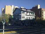
Ezeiza, Buenos Aires
| Ezeiza | |
|---|---|
 | |
 Ezeiza | |
| Coordinates: 34°50′S 58°31′W / 34.833°S 58.517°WCoordinates: 34°50′S 58°31′W / 34.833°S 58.517°W | |
| Country |
|
| Province |
|
| Partido | Ezeiza |
| Founded | July 17, 1885 |
| Elevation | 12 m (39 ft) |
| Population (2001 census [INDEC]) | |
| • Total | 93,246 |
| CPA Base | B 1804 |
| Area code(s) | +54 11 |
Ezeiza is the capital city of the Ezeiza Partido within the Greater Buenos Aires area in Argentina. The city has a population of 93,246 according to the 2001 census [INDEC]. Ezeiza is one of the fastest-growing cities in Argentina; the city and its surroundings are known for the many gated communities there, as well as for the Ministro Pistarini International Airport. Ezeiza and its surroundings is an affluent area where many well-to-do people live.
History
Inhabited originally by the Querandí people, the first Conquistador claims to land in the area took place in 1588. The first estancia (Los Remedios) and chapel in the area were founded by Juan Guillermo González y Aragón in 1758; one of González's great-grandsons was Manuel Belgrano, one of the most notable leaders of the Argentine War of Independence. Gerónimo Ezeiza bought land nearby in 1767, and by the late 19th century his descendant José María Ezeiza became the largest landowner in the area. Following his death, Ezeiza's son-in-law donated land to the Buenos Aires Western Railway, and the town was founded around the new line on July 17, 1885; it was named in honor of the late José María Ezeiza.[1]

Dairy farming dominated the Ezeiza landscape during the early 20th century.[1] The town was chosen as the site of the nation's first international airport, which was inaugurated on the northern end of the city in 1949; a new neighborhood, Barrio Uno, was built just north of the airport that year to house its employees, and the Ricchieri Freeway was opened in 1952 to connect the new airport to the city of Buenos Aires. The National Atomic Energy Commission established the Ezeiza Atomic Center, a leading producer of radioisotopes for medical use, in 1967.[2] The freeway was scene of the Ezeiza Massacre, in which at least 13 died in clashes between left and right-wing Peronists vying for the best vantage points from which to view the motorcade for exiled former President Juan Perón upon his return to Argentina on June 20, 1973.[3]
Ezeiza grew steadily afterward as a bedroom community, and a number of gated communities were developed (particularly in or near Canning, south of the city) from the 1990s onward. The Bosques de Ezeiza ('Ezeiza Woods') are likewise an important tourist attraction for the area.[1] Other important institutions include the Dr. Alberto Eurnekian Hospital (2008), and the Provincial University of Ezeiza - which opened its doors in 2012 as the first university dedicated to aeronautics in Latin America; a proposal was submitted later that year to the National University Council by the school for its nationalization.[4]
Part of Esteban Echeverría Partido since its establishment in 1913, Ezeiza was made the seat of its namesake county upon its own establishment in 1994.[5] A new, postmodern city hall was inaugurated in 2007.[6]
City sights
-
Ezeiza Woods
-

Barrio Uno
-

Paso de la Patria Street
-

Downtown architecture
Climate
| Climate data for Ezeiza, Buenos Aires, Argentina (1981-1990) | |||||||||||||
|---|---|---|---|---|---|---|---|---|---|---|---|---|---|
| Month | Jan | Feb | Mar | Apr | May | Jun | Jul | Aug | Sep | Oct | Nov | Dec | Year |
| Average high °C (°F) | 30.6 (87.1) |
28.5 (83.3) |
26.3 (79.3) |
22.4 (72.3) |
18.8 (65.8) |
15.3 (59.5) |
14.9 (58.8) |
17.2 (63) |
19.0 (66.2) |
22.2 (72) |
25.3 (77.5) |
28.3 (82.9) |
22.4 (72.31) |
| Average low °C (°F) | 17.7 (63.9) |
17.0 (62.6) |
14.6 (58.3) |
11.3 (52.3) |
7.7 (45.9) |
5.2 (41.4) |
4.7 (40.5) |
5.9 (42.6) |
7.3 (45.1) |
10.5 (50.9) |
13.4 (56.1) |
15.7 (60.3) |
10.92 (51.66) |
| Precipitation mm (inches) | 99.7 (3.925) |
110.2 (4.339) |
121.5 (4.783) |
81.7 (3.217) |
84.4 (3.323) |
41.2 (1.622) |
42.3 (1.665) |
48.2 (1.898) |
62.8 (2.472) |
123.6 (4.866) |
119.2 (4.693) |
87.4 (3.441) |
1,022.2 (40.244) |
| Source: Servicio Meteorologico Nacional[7] | |||||||||||||
References
| Wikimedia Commons has media related to Ezeiza. |
- ↑ 1.0 1.1 1.2 "Historia de Ezeiza". Municipalidad de Ezeiza.
- ↑ "CNEA".
- ↑ "Presidencia de Cámpora". Todo Argentina.
- ↑ "Razones para la Nacionalización de la Universidad Provincial de Ezeiza". UPE.
- ↑ "Esteban Echeverría". Historia Metro.
- ↑ "Inauguran el edificio Municipal en Ezeiza". 26 Noticias.
- ↑ "Weather Information for Ezeiza".
External links
- Information from the ministry of internal affairs (Spanish)
- Ezeiza portal (Spanish)
