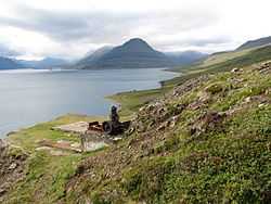
Eskifjörður
| Eskifjörður | |
|---|---|
| Town | |
 | |
 | |
 Eskifjörður | |
| Coordinates: 65°04′17.48″N 14°00′55.4″W / 65.0715222°N 14.015389°W | |
| Country |
|
| Constituency[1] | Norðausturkjördæmi |
| Region[2] | Austurland |
| County | Suður-Múlasýsla |
| Municipality |
|
| Population (2011) | |
| • Total | 1,043 |
| Time zone | GMT (UTC+0) |
| Website | Official website |
Eskifjörður (in original Icelandic spelling), or also Eskifjördur, is a town and port in eastern Iceland with a large fishing industry. It has a population of 1,043 and constitutes one of the most populated villages part of the municipality of Fjarðabyggð.
History
Eskifjörður joined Neskaupstaður and Reyðarfjörður in 1998 to form the new municipality of Fjarðabyggð ("fjords-settlement").
Geography
The other villages composing the municipality are: Fáskrúðsfjörður (662 inh.), Mjóifjörður (35 inh.), Neskaupstaður (1,437 inh.),[3] Reyðarfjörður (1,102 inh.) and Stöðvarfjörður (203 inh.).[4]
Main sights
A sculpture by Ragnar Kjartansson is located along the main road in Eskifjördur, commemorating the mariners who drowned at sea.[5]
Also, the mountain Hólmatindur is considered by the locals to be one of the most naturally beautiful in the area.
Eskifjordur has one of the most beautiful rare stone collections in iceland, with thousands of polished, cut and original stones from all over the island, Soren's and Sigurborgar Rare Stone Collection
Notable people
- Einar Bragi, poet
- Aðalsteinn Jónsson, founder of Hradfrystihus Eskifjardar / Eskja hf
References
- ↑ Political division
- ↑ Mainly statistical division
- ↑ Located in the Reyðarfjörður
- ↑ (Icelandic) Infos on Fjarðabyggð municipal website
- ↑ Becker, Kathleen (1 May 2009). Iceland. Baedeker. p. 162. ISBN 978-3-8297-6616-6. Retrieved 11 January 2011.
External links
![]() Media related to Eskifjörður at Wikimedia Commons
Media related to Eskifjörður at Wikimedia Commons
- (Icelandic) Facebook Fan page about everything in Eskifjörður
- (Icelandic) Eskifjörður page on Fjarðabyggð municipal website
- Images of Eskifjörður on Flickr
| |||||||||||
Coordinates: 65°04′17.48″N 14°00′55.4″W / 65.0715222°N 14.015389°W
