Ermera
From Wikipedia, the free encyclopedia
| Ermera | |
|---|---|
| Subdistrict and town | |
 | |
 Ermera | |
| Coordinates: 8°45′8″S 125°23′49″E / 8.75222°S 125.39694°ECoordinates: 8°45′8″S 125°23′49″E / 8.75222°S 125.39694°E | |
| Country |
|
| District | Ermera District |
| Subdistrict | Ermera |
| Suco | Poetete |
| Elevation | 1,195 m (3,921 ft) |
| Population (2006) | |
| • Total | 13,142 |
| Time zone | East Timor Standard Time (UTC+9) |

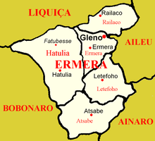
Location of Ermera in the district of Ermera
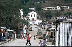
Ermera (Vila Ermera) is a city and subdistrict in Ermera District, East Timor. It has a population of 13,142. Its geographical coordinates are 8°45′8″S 125°23′49″E / 8.75222°S 125.39694°E, and it lies 1,195 metres (3,921 ft) above sea level. Ermera's center lies in the Suco of Poetete.
This article is issued from Wikipedia. The text is available under the Creative Commons Attribution/Share Alike; additional terms may apply for the media files.