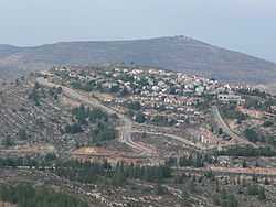
Eli, Mateh Binyamin
| Eli | |
|---|---|
 | |
 Eli | |
| Coordinates: 32°4′17.03″N 35°15′55.08″E / 32.0713972°N 35.2653000°ECoordinates: 32°4′17.03″N 35°15′55.08″E / 32.0713972°N 35.2653000°E | |
| District | Judea and Samaria Area |
| Council | Mateh Binyamin |
| Region | West Bank |
| Founded | 1984 |
| Website | www.eli.co.il |
Eli (Hebrew: עֵלִי) is a large mixed communal Israeli settlement in the West Bank. Located on Highway 60 north of Jerusalem and Ramallah, it falls under the jurisdiction of Mateh Binyamin Regional Council. At the end of 2011 it had a population of 3,200.[1] The international community considers Israeli settlements in the West Bank illegal under international law, but the Israeli government disputes this.[2]
Eli was established on 11 September 1984, when three families moved into recently placed buildings. It was the first settlement to be attempted without a core group of families. Several families from Ofra, Kokhav HaShahar, and Shilo were persuaded to come for at least a year while more families would be found. The village was originally called 'Givat Levona' after the adjacent village Ma'ale Levona.[3]
In recent years the town has evolved into the municipal center for the Shilo area settlement bloc. It has become a regular destination for French Jewish immigrants, and an ulpan has been established in nearby Ofra to aid their absorption. Eli is also home to the Bnei David pre-military Mechina academy. This yeshiva also offers post-army academic programs.
2014 Master Plan
In 2013 the Israeli Civil Administration published a master plan (no.237) which, if approved, would legitimize hundreds of the illegal structures in Eli, built with the assistance of the Israeli Housing Ministry and Amana. The plan was started by the Settlement Division of the World Zionist Organization. It covers 1000 dunams, but would allow the expansion of other outposts to embrace 6,000 dunams, including privately owned Palestinian land. Within the plan's map there are 7 Palestinian enclaves, where Palestinians may carry out agricultural projects, but are denied the right to build. The proposal would legalize constructions built on nearby Palestinian village lands, such as those of As-Sawiye and Al-Lubban ash-Sharqiya, incorporating Eli's four illegal outposts, two of which are built on lands belonging to the Palestinian village of Quaryut. Eli has fifty lots with existing housing, each of which is built partially on Palestinian land.[citation needed] The Amana website states that the development fulfils the initial vision of creating 'one long territorial contiguity' of Jewish settlers between Eli and both Shiloh and Ma'ale Levona. The plan depends on declaring collectively owned Palestinian village lands in question as ownerless under Ottoman law, a classification which allows them to be defined as "state property" reserved for Jews alone.[4] In 2013, representatives of the nearby Palestinian village of Krayot blamed Eli settlers for an alleged uprooting of more than 100 olive trees on property which they claim.[5]
Name
Eli is named after the biblical high-priest who served in the Tabernacle in nearby biblical Shiloh (1 Samuel 1:9).
Notes
- ↑ http://www.cbs.gov.il/ishuvim/ishuv2011/bycode.xls
- ↑ "The Geneva Convention". BBC News. 10 December 2009. Retrieved 27 November 2010.
- ↑ Hoberman, Haggai (2008). Keneged Kol HaSikuim [Against All Odds] (in Hebrew) (1st ed.). Sifriat Netzaim.
- ↑ Amira Hass, 'Plan to legalize West Bank settlement of Eli paves way for its expansion,' at Haaretz, 1 June, 2013.
- ↑ Jack Khoury, 'More than 100 olive trees uprooted in West Bank, Palestinians report,' at [Haaretz] Oct. 19, 2013.
External links
| ||||||||||||||