Eleftheres
From Wikipedia, the free encyclopedia
| Eleftheres Ελευθερές | |
|---|---|
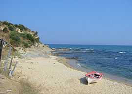 Beach in the Eleftheres Municipality | |
| Location | |
 Eleftheres | |
| Coordinates | 40°50′N 24°18′E / 40.833°N 24.300°ECoordinates: 40°50′N 24°18′E / 40.833°N 24.300°E |
Location within the regional unit  | |
| Government | |
| Country: | Greece |
| Administrative region: | East Macedonia and Thrace |
| Regional unit: | Kavala |
| Municipality: | Pangaio |
| Population statistics (as of 2001)[1] | |
| Municipal unit | |
| - Population: | 7,376 |
| Other | |
| Time zone: | EET/EEST (UTC+2/3) |
| Postal code: | 64007 |
| Telephone: | 25940 |
| Auto: | ΚΒ |
Eleftheres (Greek: Ελευθερές) is a village and a former municipality in the Kavala regional unit, East Macedonia and Thrace, Greece. Since the 2011 local government reform it is part of the municipality Pangaio, of which it is a municipal unit.[2] The seat of the municipality was Nea Peramos (pop. 2468). The other villages in this municipal unit are Agios Andreas (pop. 340), Eleftheres (pop. 1325), Elaiochori (pop. 1126), Folia] (pop. 575), Myrtofyto (pop. 484) and Nea Iraklitsa (pop. 959).
References
- ↑ De Facto Population of Greece Population and Housing Census of March 18th, 2001 (PDF 793 KB). National Statistical Service of Greece. 2003.
- ↑ Kallikratis law Greece Ministry of Interior (Greek)
- Φώτης Ο.Ε., ΕΛΛΑΣ οδικοί-τουριστικοί χάρτες, 33rd edition, 2005.
| |||||||||||||||||
This article is issued from Wikipedia. The text is available under the Creative Commons Attribution/Share Alike; additional terms may apply for the media files.