Eduardo Abaroa Province
| Location in Bolivia | |
|---|---|
 | |
| Main Data | |
| Capital | Challapata |
| Area | 3,738 km² |
| Population | 27,675 (2001) |
| Density | 7.4 inhabitants/km² (2001) |
| ISO 3166-2 | BO.OR.AB |
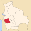
Eduardo Abaroa or Challapata is a province in the southeastern parts of the Bolivian department of Oruro.
Location
Eduardo Abaroa province is one of sixteen provinces in the Oruro Department. It is located between 18° 39' and 19° 30' South and between 65° 42' and 66° 42' West.
The province borders Poopó Province in the Northwest, Sud Carangas Province and Ladislao Cabrera Province in the West, and Potosí Department in the South and East. Furthermore, Sebastián Pagador Province is embedded between the two municipios of Eduardo Abaroa province.
The province extends over 90 km from North to South, and 100 km from East to West.
Population
Main language spoken in the province is Spanish, spoken by 78.3%, while 71.9% of the population speak Quechua and 23.0% Aymara.
The population increased from 23,147 inhabitants (1992 census) to 27,675 (2001 census), an increase of 19.6%. - 44.1% of the population are younger than 15 years old.
82% of the population have no access to electricity, 94% have no sanitary facilities.
68.9% of the population are employed in agriculture, 0.5% in mining, 6.9% in industry, 23.7% in general services (2001).
86.6% of the population are Catholics, 11.9% are Protestants (1992).
Division
The province comprises two municipalities which are further subdivided into cantons.
| Section | Municipality | Seat |
|---|---|---|
| 1st | Challapata Municipality | Challapata |
| 2nd | Santuario de Quillacas Municipality | Santuario de Quillacas |
See also
External links
Coordinates: 19°04′S 66°12′W / 19.067°S 66.200°W
| ||||||||||||||