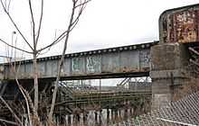
Dutch Kills, Queens


Dutch Kills is an area within Long Island City, in the New York City borough of Queens. It was a hamlet, named for its navigable tributary of Newtown Creek, that occupied what today is centrally Queensboro Plaza. Dutch Kills was an important road hub during the American Revolutionary War, and the site of a British Army garrison from 1776 to 1783. The area supported farms during the 19th Century, and was finally consolidated in 1870 with the villages of Astoria, Ravenswood, Hunters Point and Blissville to form Long Island City.[1]
The canalization of Newtown Creek and the Kills at the end of the 19th century intensified industrial development of the area, which prospered until the middle of the 20th century. The neighborhood is currently undergoing a massive rezoning of mixed residential and commercial properties.
References
- ↑ Greater Astoria Historical Society; Jackson, Thomas; Melnick, Richard (2004). Long Island City. Images of America. Charleston, SC: Arcadia Publishing. p. 10. ISBN 0-7385-3666-0.
External links
Coordinates: 40°44′49″N 73°56′24″W / 40.747°N 73.940°W
