Durazno
| Durazno | |
|---|---|
| Capital city | |
 Durazno | |
| Coordinates: 33°22′0″S 56°31′0″W / 33.36667°S 56.51667°WCoordinates: 33°22′0″S 56°31′0″W / 33.36667°S 56.51667°W | |
| Country |
|
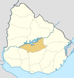
| Department | Durazno Department |
| Founded | 1821 |
| Population (2011) | |
| • Total | 34,368 |
| Time zone | UTC -3 |
| Postal code | 97000 |
| Dial plan | +598 436 (+5 digits) |
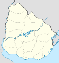
Durazno is the capital city of the department of Durazno in Uruguay.
Location
The city is located at the intersection of Routes 5 and 41, in the south of the department, close to the borders with the departments of Flores to the southwest and Florida to the southeast. It is only 40 kilometres (25 mi) northeast of the city of Trinidad, capital of Flores department.
Geography
Durazno is situated on the south banks of the Yi River, a tributary to the Río Negro River. Just across the river, is located the Santa Bernardina International Airport.
History
The town was founded on 12 October 1821, under the name of San Pedro del Durazno, as a homage to Brazilian Emperor Pedro I, at a time when the territory of present-day Uruguay had been annexed to Brazil as the Cisplatine Province. It had acquired the status of villa (town) before the independence of Uruguay. On 13 July 1906, its status was elevated to ciudad (city) by Act No. 3041.[1]
Population
According to the 2011 census, Durazno had a population of 34,368.[2]
| Year | Population |
|---|---|
| 1908 | 10,507 |
| 1963 | 22,203 |
| 1975 | 25,981 |
| 1985 | 27,834 |
| 1996 | 30,607 |
| 2004 | 30,529 |
| 2011 | 34,368 |
Source: Instituto Nacional de Estadística de Uruguay[1]
Places of worship
- St. Peter Parish Church (Roman Catholic), a national landmark by Eladio Dieste
- Parish Church of Our Lady of Mt. Carmel (Roman Catholic)
See also
References
- ↑ 1.0 1.1 "Statistics of urban localities (1908–2004) (see also "San Pedro de Durazno")" (PDF). INE. 2012. Retrieved 3 September 2012.
- ↑ "Censos 2011 Cuadros Durazno". INE. 2012. Retrieved 25 August 2012.
External links
| ||||||||||||||