Dunham Town
From Wikipedia, the free encyclopedia
Coordinates: 53°23′18″N 2°23′25″W / 53.3883°N 2.3902°W
| Dunham Town | |
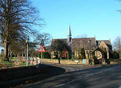
 St Mark's Church, Dunham Town |
|
 Dunham Town | |
| OS grid reference | SJ740880 |
|---|---|
| Civil parish | Dunham Massey |
| Metropolitan borough | Trafford |
| Metropolitan county | Greater Manchester |
| Region | North West |
| Country | England |
| Sovereign state | United Kingdom |
| Post town | ALTRINCHAM |
| Postcode district | WA14 |
| Dialling code | 0161 |
| Police | Greater Manchester |
| Fire | Greater Manchester |
| Ambulance | North West |
| EU Parliament | North West England |
| UK Parliament | Altrincham and Sale West |
| |
Dunham Town is a village in the civil parish of Dunham Massey in the Metropolitan Borough of Trafford, Greater Manchester, England. It was historically a part of Cheshire.
History
Dunham Town previously formed part of the parish of Bowdon, in the hundred of Bucklow.[1]
Geography
Dunham Town is in the Bowdon ward of the Metropolitan Borough of Trafford.
Neighbouring settlements include Altrincham, Bowdon, Dunham Woodhouses, Little Bollington and Partington.
Dunham Park lies to the south of the village. It was designated a site of special scientific interest in 1965 because of its biological content. Dunham Park has been managed by the National Trust since 1976.
References
- ↑ "Dunham Massey Tn/CP Cheshire through time: Administrative history of Parish-level Unit: hierarchies, boundaries". A Vision of Britain through Time. University of Portsmouth & others. 2008. Retrieved 2009-01-28.
"Dunham Park citation sheet". English Nature. Retrieved 2007-02-15.
External links
| ||||||||||||||||||||
This article is issued from Wikipedia. The text is available under the Creative Commons Attribution/Share Alike; additional terms may apply for the media files.