Drvenik Veliki
 Satellite image of Drvenik Veliki | |
| Geography | |
|---|---|
| Location | Adriatic Sea |
| Coordinates | 43°26′39″N 16°08′44″E / 43.444226°N 16.145439°ECoordinates: 43°26′39″N 16°08′44″E / 43.444226°N 16.145439°E |
| Area | 12.07 km2 (4.66 sq mi) |
| Highest elevation | 178 m (584 ft) |
| Country | |
|
Croatia | |
| County | Split-Dalmatia |
| Demographics | |
| Population | 150 (as of 2011) |
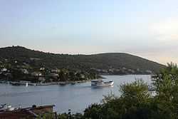
Drvenik Veliki (pronounced [dr̩v̞ɛ̌niːk v̞ɛ̂likiː]; sometimes called Drvenik veli, Italian: Zirona Grande) is an island in Croatian part of Adriatic Sea. It is situated in middle-Dalmatian archipelago, northwest of Šolta, 1.8 kilometres (1.1 miles) from the mainland.[1] Its area is 12.07 square kilometres (4.66 sq mi).[2][3] The highest peak is 178 metres high.[3] The only settlement on the island is the eponymous village with population of 168 (2001 Croatian census).[4] The island was first inhabited in the 15th century.[5] Croatian monuments from the 13th century, the island is mentioned as "Gerona" or "Giruan".[5] Main industries are agriculture, fishing and tourism.[5][6] Coast of the island is constituted of many sand and pebble beaches.[6]
References
- ↑ (Croatian) Basic facts about Drvenik
- ↑ Duplančić Leder, Tea; Ujević, Tin; Čala, Mendi (June 2004). "Coastline lengths and areas of islands in the Croatian part of the Adriatic Sea determined from the topographic maps at the scale of 1 : 25 000" (PDF). Geoadria (Zadar) 9 (1): 5–32. Retrieved 2011-01-21.
- ↑ 3.0 3.1 Statistical yearbook for 2006 of Central bureau of statistics of Republic of Croatia
- ↑ City of Trogir, list of settlements Croatian Bureau of Statistics (Croatian)
- ↑ 5.0 5.1 5.2 (Croatian) General Encyclopedia of the Yugoslavian Lexicographical Institute, volume 2 (Zagreb, 1977), article Drvenik veli.
- ↑ 6.0 6.1 (Croatian) First Croatian online peljar
External links
| Wikimedia Commons has media related to Drvenik Veli. |
- (Croatian) Web site dedicated to Drvenik veliki
| |||||