Driemond
| Driemond | |
|---|---|
| Town | |
 | |
 | |
| Coordinates: 52°18′N 5°1′E / 52.300°N 5.017°ECoordinates: 52°18′N 5°1′E / 52.300°N 5.017°E | |
| Country | Netherlands |
| Province | Noord-Holland |
| Municipality | Amsterdam |
| Borough | Amsterdam Zuidoost |
| Population | |
| • Total | 1,500 |
| Time zone | CET (UTC+1) |
| • Summer (DST) | CEST (UTC+2) |

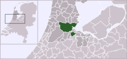
Driemond is a town in the Dutch province of North Holland. It is a part of the municipality of Amsterdam, and lies about 11 km west of Bussum.
In 2001, the town of Driemond had 1422 inhabitants. The built-up area of the town was 0.2 km², and contained 571 residences.[1] The statistical district "Driemond", which covers the village and the surrounding countryside, has a population of around 1500.[2]
Before 1966 Driemond was part of the municipality of Weesperkarspel and named "Geinbrug". The name "Driemond" means "Threemouth" and comes from the three small rivers Gein, Gaasp and Smal Weesp that meet each other in the village. The name Driemond was also the name of a country estate ("buitenplaats") that once stood near the village, but except for the fountain that can be admired in Frankendael in the Watergraafsmeer in Amsterdam, nothing remains of this building.
The village contains two primary schools, kindergarten, a small post office and supermarket and a football club called SV Geinburgia.
References
- ↑ Statistics Netherlands (CBS), Bevolkingskernen in Nederland 2001 . Statistics are for the continuous built-up area.
- ↑ Statistics Netherlands (CBS), Statline: Kerncijfers wijken en buurten 2003-2005 . As of 1 January 2005.
| ||||||||||||||||||||||||||||||||