Drewton
From Wikipedia, the free encyclopedia
Coordinates: 53°46′59″N 0°36′33″W / 53.783181°N 0.609154°W
| Drewton | |
 Drewton | |
| OS grid reference | SE917327 |
|---|---|
| - London | 165 mi (266 km) south |
| Civil parish | South Cave |
| Unitary authority | East Riding of Yorkshire |
| Ceremonial county | East Riding of Yorkshire |
| Region | Yorkshire and the Humber |
| Country | England |
| Sovereign state | United Kingdom |
| Post town | BROUGH |
| Postcode district | HU15 |
| Dialling code | 01430 |
| Police | Humberside |
| Fire | Humberside |
| Ambulance | Yorkshire |
| EU Parliament | Yorkshire and the Humber |
| UK Parliament | Haltemprice and Howden |
Drewton is a hamlet in the East Riding of Yorkshire, England. It is situated on the A1034 road, 6 miles (9.7 km) south-east from Market Weighton and 11 miles (18 km) west from Hull city centre, and forms part of the civil parish of South Cave.
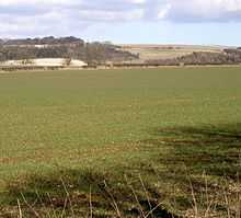
Farmland around Drewton, 2006
In the 1086 Domesday Book Drewton is written as "Drowetone". The manor, in the East Riding Hundred of Cave, comprised 11 households, 6 villagers and 5 smallholders, with 2 ploughlands. Lordship of the manor of Drewton had passed to Robert Malet, who also became Tenant-in-chief.[1][2]
See also
References
- ↑ Drewton in the Domesday Book. Retrieved 4 June 2012.
- ↑ "Documents Online: Drewton, Yorkshire", Great Domesday Book, Folios: 320v, 381v; The National Archives. Retrieved 14 June 2012
- Gazetteer — A–Z of Towns Villages and Hamlets. East Riding of Yorkshire Council. 2006. p. 5.
External links
![]() Media related to Drewton at Wikimedia Commons
Media related to Drewton at Wikimedia Commons
This article is issued from Wikipedia. The text is available under the Creative Commons Attribution/Share Alike; additional terms may apply for the media files.