Dover
| Dover | |
 Aerial view of Dover Harbour |
|
 Dover | |
| Population | 28,156 (2001 Census) Urban area 39,078 |
|---|---|
| OS grid reference | TR315415 |
| - London | 77.8mi |
| District | Dover |
| Shire county | Kent |
| Region | South East |
| Country | England |
| Sovereign state | United Kingdom |
| Post town | DOVER |
| Postcode district | CT16, CT17 |
| Dialling code | +44 (0)1304 |
| Police | Kent |
| Fire | Kent |
| Ambulance | South East Coast |
| EU Parliament | South East England |
| UK Parliament | Dover |
Dover (/ˈdoʊvər/; French: Douvres) is a town and major ferry port in the home county of Kent, in South East England. It faces France across the narrowest part of the English Channel, and lies south-east of Canterbury; east of Kent's administrative capital Maidstone; and north-east along the coastline from Dungeness and Hastings. The town is the administrative centre of the Dover District and home of the Dover Calais ferry through the Port of Dover. The surrounding chalk cliffs have become known as the White Cliffs of Dover, and the narrow sea passage nearby – the Strait of Dover.[1] Its strategic position has been evident throughout its history: archaeological finds have revealed that the area has always been a focus for peoples entering and leaving Britain. The name of the town derives from the name of the river that flows through it, the River Dour. The town has been inhabited since the Stone Age according to archaeological finds, and Dover is one of only a few places in Britain – London and Cornwall being other examples – to have a corresponding name in the French language, Douvres.[2]
There was a military barracks in Dover, which was closed in 2007.[citation needed] Although many of the former ferry services have declined, services related to the Port of Dover provide a great deal of the town’s employment, as does tourism. The prospect of privatising the sale of the Port of Dover to create increased cash flow for the government was given a recent ironic twist due to the rejection of a possible bid from the town of Calais in France after opposition in Dover against any sale forced the government to withdraw the Port from the market:
- Local residents had clubbed together to propose buying it for the community. More than 12,000 people have bought a £10 share in the People's Port Trust but optimism that this would transform Dover has been short lived.
History
.JPG)
Dover’s name originated with its river – the River Dour,[3] deriving from the Brythonic Dubrās ("the waters"), via its Latinised form of Dubris. The cliffs also gave England its ancient name of Albion ("white"). The Romans called it ’’Portus Dubris’’; the modern name was in use at least by the time Shakespeare wrote King Lear (between 1603 and 1606), in which the town and its cliffs play a prominent role.
Dover’s history, because of its proximity to France, has always been of great strategic importance to Britain. Archaeological finds have shown that there,were Stone Age people in the area; and that by the Bronze Age the maritime influence was already strong. Some Iron Age finds exist also, but the coming of the Romans made Dover part of their communications network. Like Lemanis (Lympne) and Rutupiae (Richborough) Dover was connected by road to Canterbury and Watling Street; and it became Portus Dubris, a fortified port. Forts were built above the port; lighthouses were constructed to guide passing ships; and one of the best-preserved Roman villas in Britain is here.
Dover figured largely in the Domesday Book as an important borough. It also served as a bastion against various attackers: notably the French during the Napoleonic Wars; and against Germany during World War II. It was one of the Cinque Ports during mediaeval times.[citation needed]
Geography

Dover is near the extreme south-east corner of Britain. At South Foreland, the nearest point to the continent, Cap Gris Nez near Calais is 34 kilometres (21 mi) away, across the Strait of Dover.[4]
The site of its original settlement lies in the valley of the River Dour, making it an ideal place for a port, sheltered from the prevailing south-westerly winds. This led to the silting up of the river mouth by the action of longshore drift; the town was then forced into making artificial breakwaters to keep the port in being. These breakwaters have been extended and adapted so that the port lies almost entirely on reclaimed land.
The higher land on either side of the valley – the Western Heights and the eastern high point on which Dover Castle stands – has been adapted to perform the function of protection against invaders. The town has gradually extended up the river valley, encompassing several villages in doing so. Little growth is possible along the coast, since the cliffs are on the sea’s edge. The railway, being tunnelled and embanked, skirts the foot of the cliffs.
Climate
Dover has an oceanic climate (Koppen classification Cfb) similar to the rest of England and the United Kingdom with moderate temperatures year-round and light precipitation each month.
| Climate data for Dover | |||||||||||||
|---|---|---|---|---|---|---|---|---|---|---|---|---|---|
| Month | Jan | Feb | Mar | Apr | May | Jun | Jul | Aug | Sep | Oct | Nov | Dec | Year |
| Average high °C (°F) | 6 (43) |
7 (44) |
9 (48) |
11 (52) |
15 (59) |
18 (65) |
23 (73) |
22 (71) |
19 (67) |
16 (60) |
10 (50) |
7 (44) |
13 (56) |
| Average low °C (°F) | 1 (34) |
1 (34) |
2 (36) |
4 (40) |
7 (45) |
11 (51) |
14 (57) |
13 (56) |
11 (52) |
8 (47) |
4 (40) |
2 (36) |
7 (44) |
| Precipitation mm (inches) | 46 (1.8) |
33 (1.3) |
41 (1.6) |
43 (1.7) |
38 (1.5) |
48 (1.9) |
46 (1.8) |
46 (1.8) |
56 (2.2) |
61 (2.4) |
66 (2.6) |
48 (1.9) |
572 (22.5) |
| Source: [5] | |||||||||||||
Demography
In 1800 Edward Hasted (1732–1812) reported that the town had a population of almost 10,000 people.[6]
At the 2001 census, the town of Dover had 28,156 inhabitants, while the population of the whole urban area of Dover, as calculated by the Office for National Statistics, was 39,078 inhabitants.[7]
With the expansion of Dover, many of the outlying ancient villages have been incorporated into the town. Originally the parishes of Dover St. Mary's and Dover St. James, since 1836 Buckland and Charlton have become part Dover, and Maxton (a hamlet to the west), River, Kearsney, Temple Ewell, and Whitfield, all to the north of the town centre, are within its conurbation.
Economy
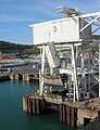
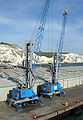
Shipping
.JPG)
The Dover Harbour Board[8] is the responsible authority for the running of the Port of Dover. The English Channel, here at its narrowest point in the Straits of Dover, is the busiest shipping lane in the world. Ferries crossing between here and the Continent have to negotiate their way through the constant stream of shipping crossing their path. The Dover Strait Traffic Separation Scheme allots ships separate lanes when passing through the Strait. The Scheme is controlled by the Channel Navigation Information Service based at Maritime Rescue Co-ordination Centre Dover. MRCC Dover is also charged with co-ordination of civil maritime search and rescue within these waters.[9]
The Port of Dover is also used by cruise ships. The old Dover Marine railway station building houses one passenger terminal, together with a car park. A second, purpose built, terminal is located further out along the pier.[10]
The ferry lines using the port are (number of daily sailings in parentheses):
- to Calais: P&O Ferries (25) and DFDS Seaways (10).
- to Dunkerque: DFDS Seaways (11).
These services have been cut in recent years:
- P&O Ferries sailings to Boulogne (5 daily) were withdrawn in 1993 and Zeebrugge (4 daily) in 2002.
- SNCF withdrew their three train ferry sailings on the opening of the Channel Tunnel.
- Regie voor Maritiem Transport[11][12] moved their Ostend service of three sailings daily to Ramsgate in 1994; this route was operated by TransEuropa Ferries until April 2013.
- Stena Line merged their 20 Calais sailings into the current P&O operation in 1998.
- Hoverspeed ceased operations in 2005 and withdrew their 8 daily sailings.
- SpeedFerries ceased operations in 2008 and withdrew their 5 daily sailings.
- LD Lines ceased the Dover-Dieppe service on 29 June 2009 and Dover-Boulogne 5 September 2010.
The Dover lifeboat is a Severn class lifeboat based in the Western Docks.[13]
Transport
Dover’s main communications artery, the A2 road replicates two former routes, connecting the town with Canterbury. The Roman road was followed for centuries until, in the late 18th century, it became a toll road. Stagecoaches were operating: one description stated that the journey took all day to reach London, from 4am to being “in time for supper”.[14]
The other main roads, travelling west and east, are the A20 to Folkestone and thence to London and the A258 through Deal to Sandwich.
The railway reached Dover from two directions: the South Eastern Railway's main line connected with Folkestone in 1844, and the London, Chatham and Dover Railway opened its line from Canterbury in 1861. Trains run from Dover Priory to either London Charing Cross, London Victoria or London St Pancras International railway stations in London, and Ramsgate or Sandwich in Kent in terms of final destinations. Trains from Dover Priory are run by Southeastern (train operating company).
A tram system operated in the town from 1897 to 1936.
Dover has two long distance footpaths: the Saxon Shore Way and the North Downs Way. Two National Cycle Network routes begin their journey at the town.
Also, the ferry to Calais is a popular transport. From Dover to Calais it usually takes one and a half hours to cross the Strait of Dover. The Strait of Dover is the stretch of water between Dover and Calais, and also the stretch of water the Dover-Calais and Calais-Dover ferries cross.
More recently, ferries on the Dover to Dunkirk route have also become popular. This service was originally operated by ferry operator Norfolkline. This company was later acquired by the pan European operator DFDS Seaways in July 2010 .[15] The crossing time is approximately two hours.[16] Due to this route not being as well known as Dover to Calais, prices are often cheaper.[17] The location of Dunkirk is also more convenient for those travelling on to countries in Northern Europe including Belgium, the Netherlands, Germany and further afield.
Stagecoach in East Kent provide local bus services. Dover is on the Stagecoach Diamond network providing links to Canterbury 15, 15A, 15B every 15 minutes and Deal 15, 15A every 30 minutes. The Diamond 15A route serves the Western Docks at the port of Dover from the Town Centre as well as Canterbury and Deal. Dover is also the start of The Wave network running every 15 minutes to New Romney 101 and 102 via Folkestone, Hythe and Dymchurch. 2 buses per hour are 101 services to Lydd via Lydd Airport, with one continuing from Lydd on to Hastings via Camber and Rye. Two buses per hour are 102 service, with one trminating at New Romney and the other to Lydd-on-Sea via Greatstone. Routes 87 and 88 provide a link to Sandwich and Ramsgate. Route 89 runs from Dover to Canterbury via Aylesham. Stagecoach also provide Dover with The Heart network 60, 61, 62 and 63. Just like nearby Folkestone, the Dover local routes run from the Town Centre to the outskirts of the town and to Tesco and B&Q.
National Express runs coaches from Dover to other towns in Kent including Canterbury, Folkestone, Ashford, Kent, Maidstone, Gillingham at Hempsted Valley shopping centre and Greenhithe at Bluewater Shopping Centre for Dartford to London including Bexleyheath, Eltham, Walworth, Canary Wharf, Elephant & Castle, The City (The City of London) and to Victoria Coach Station
All buses serve Pencester Road except route 68 to Maxton operated by Regent Coaches.
Retail
The town's main shopping streets are the High Street and Biggin Street. There is also the Castleton Retail Park to the north-west of the town centre.
The town has a number of retail chains, including Marks and Spencer, Boots, WH Smith, Costa Coffee, a large Peacocks store in the former Woolworths store, and branches of Dorothy Perkins, and Burton Menswear as well as Argos.
There are a number of empty shops in Dover, as is also the case nationally but Dover Town Centre has fallen behind other comparable towns since the 1980s and increasing number of retailers are no longer represented in the town including H. Sameul, Evans, Internaccionale, Thomas Cook / Co-operative Travel, Millets and Barratts, Bon Marche, Johnsons Drycleaners, and Vodafone.
There are long awaited plans to redevelop the St James area of the town centre but these are taking a while for fruition. Due to demographics and income, Dover like many places has been successful in attracting Poundland, Morrisons, Greggs and Brighthouse as retail stores to the town centre and is seeing a re-emergence of independent stores in what is prime retail area of Biggin Street and High Street. There are more charity shops as is common across the country in the current economic environment.
There are plans to open a 6 screen Cineworld Cinema and leisure element ( Restaurants) at St James but not until 2017. It has been recently announced that Marks and Spencer will relocate to St James Development and that the current M and S general store will close. The new 16,000 sq feet store at St James will be an M and S Simply Food with café only and will not sell clothing or homeware unlike the current store which will shut in 2016. It's thought the new M and S will cater for passing Belgium and French tourist trade rather than to the benefit of Dover people and Dover Town Centre. Simmonds Jeweller's will also close their Dover branch after 40 years in January 2014. The M and S general store and Simmonds branch in nearby Deal will remain open.
Independent stores continue to grow in Dover, but the main town centre of Dover remains in decline compared to other towns like Folkestone, Canterbury, Westwood Cross and Ashford who continue to take trade away from Dover and Dover District.
Marks and Spencer Simply food is the only anchor store at the new St James and as of December 2013, the only retailer confirmed for the development. However, there is a big possibility that there will be an exodus of existing chains from Biggin Street and Cannon Street to the new development leaving Dover Town Centre increasingly empty as will be the case with the large M and S store which has been in Dover for over a 100 years.
RNLI
Dover Lifeboat station is based at crosswall quay in Dover Harbour. There is a Severn-class lifeboat, which is the biggest in the fleet. It belongs to the RNLI which covers all of Great Britain. The lifeboat number is 17-09 and has a lot of emergencies in the Channel. The Severn class is designed to lay afloat. Built from fibre reinforced composite (FRC) the boat is lightweight yet very strong and is designed to right itself in the event of a capsize.
Education
There are nine secondary level schools, 16 primary schools and two schools for special education.
Several of the state secondary schools now specialise: Astor College for the Arts; Dover Grammar School for Girls is a selective specialist Humanities College; Dover Grammar School for Boys, a selective Business and Enterprise College; St Edmund's Catholic School, specialising in Performing Arts; and Dover Christ Church Academy, a specialist Maths, ICT and Music Academy.
The Duke of York's Royal Military School, England's only military boarding school for children of service personnel (co-ed ages 11–18), is also located in Dover, next to the former site of Connaught Barracks.
Dover College, a public school was founded in 1871 by a group of local business men.[18]
Public services
Dover has one hospital, Buckland Hospital[19] located in a former Victorian workhouse on Coombe Valley Road. The town once had four hospitals, Buckland, Royal Victoria, Isolation and the Eye Hospitals located at various points across the town. Buckland Hospital is currently (2008) threatened with closure and various local organisations are trying to stop the cuts facing the hospital.[20] Astor College for the Arts federated with St Radigunds Primary School (then renamed White Cliffs Primary College for the Arts) to form the Dover Federation for the Arts (DFA). Subsequently Barton Junior School and Shatterlocks Nursery and Infant School joined the DFA. It has been a very successful Federation recognised by OFSTED with two schools rated as Outstanding and two being Good with outstanding features. Currently (November 2011) the DFA have applied to become a Federation of Academies.[citation needed]
As of January 2013, Buckland Hospital is to be rebuilt as a new community hospital on the same site, which will mean the loss of consultant clinics in Deal and likely total closure of the Deal Hospital site which has angered many people in Deal, who will be faced with a 50-minute round trip or more to the new hospital at Buckland once this is completed by 2015.[citation needed]
Local media
Television
Dover was the home to television studios and production offices of Southern Television Ltd, the company which operated the ITV franchise for South and South East England from 1958-1981. The studios were located on Russell Street and were home to programmes like 'Scene South East', 'Scene Midweek', 'Southern News', 'Farm Progress' and the nightly epilogue, 'Guideline'. The studios were operated by TVS in 1982 and home to 'Coast to Coast', however they closed a year later when the company moved their operations to the newly complete Television Centre in Maidstone.
Newspapers
Dover has two paid for newspapers, the Dover Express (published by Kent Regional News and Media) and the Dover Mercury (published by the KM Group). Free newspapers for the town include the Dover and Deal Extra, part of the KM Group; and yourdover, part of KOS Media.
Radio
Dover has one local commercial radio station, KMFM Shepway and White Cliffs Country, broadcasting to Dover on 106.8FM. The station was founded in Dover as Neptune Radio in September 1997 but moved to Folkestone in 2003 and was consequently rebranded after a takeover by the KM Group. Dover is also served by the county-wide stations Heart, Gold and BBC Radio Kent.
The Gateway Hospital Broadcasting Service, in Buckland Hospital radio, closed at the end of 2006. It was the oldest hospital radio station in East Kent being founded in 1968.[21]
Dover Community Radio (DCR) currently offer internet programming and podcasts on local events and organisations on their website. The online station of the same name launched on 30 July 2011 offering local programmes, music and news for Dover and district.[22]
Culture
There are three museums: the main Dover Museum,[23] the Dover Transport Museum,[24] and the Roman Painted House.[25]
International relations
Twin towns / Sister cities
Dover has three twin towns:
Sports
Dover Leisure Centre, is operated by Your Leisure, a not for profit charitable trust,[28] caters for a wide range of sports and activities including a 25m swimming pool, teaching pool, sports hall, gym, fitness classes, sauna and steam room, is located on Townwall Street.
There are sports clubs catering for the usual range of sports, among them football (Dover Athletic F.C.); rugby; rowing; swimming; water polo and netball (Dover and District Netball League).[29]
One event which gets media attention is that of swimming the English Channel.[30]
Sea fishing, from the beach, pier or out at sea, is carried out here.[31] The so-called Dover sole (solea solea) is found all over European waters.
Places of interest
- Blériot memorial: the outline of Blériot's aircraft, marked with granite setts, at the exact spot where Blériot landed after the first cross-Channel flight, 1909[32]
- Dover Castle
- The White Cliffs of Dover
- Dover Western Heights
- Dover Museum
- Roman Painted House Museum
- Dover Transport Museum
- Samphire Hoe
- Seafront promenade
- South Foreland Lighthouse
- The Pines Gardens
- St Edmund's Chapel
- Connaught Park
- Kearsney Abbey
- Russel Gardens & Bushy Ruff
Notable people
Gallery
 Dover Harbour, from the cliffs above.
.JPG)
.JPG)
.JPG)
.JPG)
.JPG)
References
- ↑ The French name for the Strait is Le Pas-de-Calais
- ↑ "Liste des noms français de toponymes britanniques - Wikipédia" (in (French)). Fr.wikipedia.org. 3 April 2010. Retrieved 2010-04-18.
- ↑ Plea Rolls of the Court of Common Pleas; National Archives; CP 40/647; http://aalt.law.uh.edu/AALT1/H6/CP40no647/bCP40no647dorses/IMG_0801.htm, first entry, with "Kant'" in the margin. One of the defendants, on line 4, is from "Douorre" or "Doverre"
- ↑ "Eosnap.com". Eosnap.com. Retrieved 2011-08-26.
- ↑ "Dover monthly weather".
- ↑ "Hasted description of Dover". British-history.ac.uk. 29 January 1998. Retrieved 2011-08-26.
- ↑ "KS01 Usual resident population: Census 2001, Key Statistics for urban areas". National Statistics. Retrieved 2007-06-08.
- ↑ "Dover Harbour Board". Doverport.co.uk. Retrieved 2011-08-26.
- ↑ "The Dover Strait Traffic Navigation Scheme and rules relating thereto". Mcga.gov.uk. Retrieved 2011-08-26.
- ↑ "Cruise Port Passenger Guide". Port of Dover. Retrieved 18 July 2012.
- ↑ Ostende ferry
- ↑ "Telenet.be". Users.telenet.be. 19 September 1996. Retrieved 2011-08-26.
- ↑ "The Dover lifeboat". The Dover lifeboat. 7 August 2011. Retrieved 2011-08-26.
- ↑ "From ''The Life of Thomas Telford''". Worldwideschool.org. Retrieved 2011-08-26.
- ↑ "DFDS Seaways acquires Norfolkline". DFDS Seaways. Retrieved 2013-12-16.
- ↑ "Norfolk Line Ferries | Book Norfolk Line Ferries | Timetable, Offers, Reviews & Routes". AFerry.co.uk. Retrieved 2013-03-26.
- ↑ Travel advice. "Travel advice: cheap ferry crossings to France". Telegraph. Retrieved 2013-03-26.
- ↑ "Dover College". Dover College. Retrieved 2011-08-26.
- ↑ Buckland Hospital
- ↑ "Stopping the hospital cuts". BBC News. 18 May 2007. Retrieved 2011-08-26.
- ↑ GHBS closure
- ↑ "Dover Community Radio Website". Dovercommunityradio.co.uk. 31 July 2011. Retrieved 2011-08-26.
- ↑ "Dover Museum website". Dover.gov.uk. Retrieved 2011-08-26.
- ↑ "Dover Transport Museum". Dovertransportmuseum.homestead.com. Retrieved 2011-08-26.
- ↑ "The Roman Painted House, Dover- Homepage". Theromanpaintedhouse.co.uk. Retrieved 2011-08-26.
- ↑ "British towns twinned with French towns [via WaybackMachine.com]". Archant Community Media Ltd. Archived from the original on 5 July 2013. Retrieved 2013-07-20.
- ↑ "Gradovi prijatelji Splita" [Split Twin Towns]. Grad Split [Split Official City Website] (in Croatian). Archived from the original on 2012-03-24. Retrieved 2013-12-19.
- ↑ "Dover Leisure Centre". Vistaleisure.com. Retrieved 2011-08-26.
- ↑ "Netaball league". Doveranddistrictnetballleague.co.uk. Retrieved 2011-08-26.
- ↑ Whyte Studio. "Channel Swimming". Dover.uk.com. Retrieved 2011-08-26.
- ↑ "Sea Fishing". Doverpages.co.uk. Retrieved 2011-08-26.
- ↑ "Dover Aeroplane". Hows.org.uk. Retrieved 2010-04-18.
Bibliography
- Statham, S.P.H. (1899). The history of the castle, town, and port of Dover. London: Longmans Green & Co. pp. 462 p.
- Foot, William (2006). Beaches, fields, streets, and hills ...: the anti-invasion landscapes of England, 1940. CBA research report 144. York: Council for British Archaeology. ISBN 1-902771-53-2.
Related Links
External links
| Wikimedia Commons has media related to Dover. |
- UKHO nautical charts of Dover and approaches
- Official site
- Dover Latest News
- Dover Street Map
- The Dover War Memorial Project
- Dover Locals
- Dover Soul Local Community Website
- Western Heights Preservation Society
- Friends of Dover Castle A scheme for the local people of Dover to contribute and benefit from their Castle.
- Dover Community Radio Dover District's podcasting service, an online radio service for the town and surrounding area.