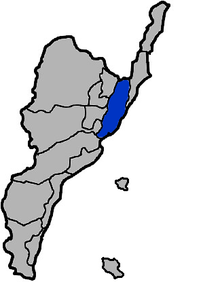
Donghe, Taitung


Donghe Township (Chinese: 東河鄉; pinyin: Dōnghé Xiāng; Wade–Giles: Tung1-ho2 Hsiang1; literally "east river township") is a rural township located in northeastern Taitung County, Taiwan.
Geography
It is bounded on the northeast by Chenggong, east by Pacific Ocean, west by neighboring Chihshang Township, Guanshan Township, and Luye Township, and south by Beinan Township.
This township is located on the east side of coastal mountain range. It includes 60% of the hillside onshore, divided into coastal and basin areas with gradual upland slopes merging into relatively flat sea stage plains, the area of major development. Basin streams are mainly north-south because of the difficult terrain. Climate is tropical monsoon climate.
Rural residents are Taiwanese aboriginal Ami mainly. The major industry is agriculture.
History
Donghe Township has an old name of Ma Wu Cave (馬武窟), which means "fishing by net" in Amis language. Under Qing dynasty rule, the township was under jurisdiction of the Office of the Peinan and Taitung direct-controlled state jurisdiction. Donghe Field was set up in 1920. In 1937, it was changed to "Donghe Village", and assigned to the Xingong prefectures, Office of Taitung. The name "Donghe Township" was established after World War II and is currently used
Traffic
- Provincial Highway No. 11
- Provincial Highway No. 23
Education
Junior High Schools
Elementary Schools
- Donghe Elementary School, Dongher Township, Taiwan East County
- Dulan Elementary School, Donghe Township, Taitung County
- Sinlong School,Donghe Township, Taitung County
- Taiyuan Elementary School, Donghe Township, Taitung County
Tourist attractions
- Jinzun Fish Port[1]
- Old Donghe Bridge
See also
References
External links
| Wikimedia Commons has media related to Donghe Township, Taiwan. |
| |||||||||||||||||
