Domloup
From Wikipedia, the free encyclopedia
| Domloup Domloup | ||
|---|---|---|
 | ||
| ||
 Domloup | ||
|
Location within Brittany region  Domloup | ||
| Coordinates: 48°03′46″N 1°31′19″W / 48.0628°N 1.5219°WCoordinates: 48°03′46″N 1°31′19″W / 48.0628°N 1.5219°W | ||
| Country | France | |
| Region | Brittany | |
| Department | Ille-et-Vilaine | |
| Arrondissement | Rennes | |
| Canton | Châteaugiron | |
| Intercommunality | Pays de Châteaugiron | |
| Government | ||
| • Mayor (2008–2014) | André Lelièvre | |
| Area | ||
| • Land1 | 18.55 km2 (7.16 sq mi) | |
| Population (2008) | ||
| • Population2 | 3,001 | |
| • Population2 Density | 160/km2 (420/sq mi) | |
| INSEE/Postal code | 35099 / 35410 | |
| Elevation | 33–87 m (108–285 ft) | |
|
1 French Land Register data, which excludes lakes, ponds, glaciers > 1 km² (0.386 sq mi or 247 acres) and river estuaries. 2 Population without double counting: residents of multiple communes (e.g., students and military personnel) only counted once. | ||
.svg.png)
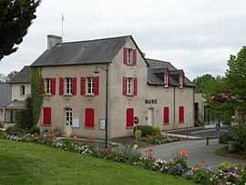
Domloup (Breton: Domloup) is a commune in the Ille-et-Vilaine department in Brittany in northwestern France.
Population
Inhabitants of Domloup are called Domloupéens in French.
| Historical population | ||
|---|---|---|
| Year | Pop. | ±% |
| 1962 | 652 | — |
| 1968 | 674 | +3.4% |
| 1975 | 863 | +28.0% |
| 1982 | 1,241 | +43.8% |
| 1990 | 1,501 | +21.0% |
| 1999 | 2,432 | +62.0% |
| 2008 | 3,001 | +23.4% |
See also
References
External links
- Official website (French)
- French Ministry of Culture list for Domloup (French)
This article is issued from Wikipedia. The text is available under the Creative Commons Attribution/Share Alike; additional terms may apply for the media files.