Dishman Hills

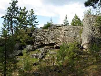
Dishman Hills Natural Resources Conservation Area is a 530 acre (2.14 km²) area protected by a combination of public (Spokane County Parks and Recreation Department and Washington Department of Natural Resources) and non-profit (Dishman Hills Natural Area Association) groups, located in Spokane County, Washington. The Granite outcroppings, forming the bulk of the area, were originally formed 70 million years ago, by volcanic magma pushing up through the Earth's crust and then cooling. The current state of the rock was formed between 13,000 and 15,000 years ago by the Missoula Floods. The hills consist of small ravines, ponds, and large chunks of granite, that support an eco-system consisting mainly of ponderosa pine, as well as about 300 different flowering plants (including Indian Camas), and 73 different species of mushrooms.[1] The area also supports wildlife, such as coyotes, marmots, white-tailed deer, pheasants, and dozens of species of butterflies.
The Dishman Hills rise immediately south of the Dishman section of The City of Spokane Valley. Continuing south, out of the park, the elevation continues to rise to the peak of Krell Hill.
2008 Fire
On Thursday, July 10, 2008 at about 3:30 PM local time, the Valley View Fire started in the Dishman Hills area.[2] As of Friday morning it burned 1,200 acres (4.9 km2) and destroyed 11 homes. Washington State Governor Chris Gregoire declared a state of emergency for Spokane County. A mandatory evacuation was ordered in the area and two shelters were set up around Spokane Valley.
A follow up story by the Spokesman Review on July 16, 2008 revealed that the fire's origin was a smoldering fire made by a resident of South Eastern Lane. The smoldering fire had been started days before the Dishman Hills Fire, and was left unattended inside of an old tree stump before it was whipped up by fierce winds on the afternoon of Thursday, July 11.[3] These same winds spread the fire quickly across the Dishman Hills and threatened hundreds of homes along Dishman-Mica Road. Moreover, many homes in the Park Drive area (between the fire's origin and the Dishman Hills Natural Area) were in the direct path of the fire.
Among other things, some factors in the spread of the fire were the unprecedented wind speeds,[4] and the amount of natural fuel in the Dishman Hills area (especially, fast burning ground fuels sprouted following Spokane's long winter).
References
External links
Coordinates: 47°38′48″N 117°17′13″W / 47.64667°N 117.28694°W