Diktel
From Wikipedia, the free encyclopedia
| Diktel दिक्तेल | |
|---|---|
| Village Development Committee | |
 | |
 Diktel | |
| Coordinates: 27°12′50″N 86°47′52″E / 27.21389°N 86.79778°ECoordinates: 27°12′50″N 86°47′52″E / 27.21389°N 86.79778°E | |
| Country |
|
| Zone | Sagarmatha Zone |
| District | Khotang District |
| Elevation | 1,530 m (5,020 ft) |
| Population (1991) | |
| • Total | 7,324 |
| Time zone | Nepal Time (UTC+5:45) |
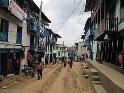
Diktel is the headquarters of Khotang District, a part of Sagarmatha Zone, Nepal. At the time of the 1991 Nepal census it had a population of 7,324 persons residing in 1,433 individual households.[1]
The town is located at 27°12′50″N 86°47′52″E / 27.21389°N 86.79778°E and has an altitude of 1,530 metres (5,020 ft). It contains a notable jail.[2] During the Civil War the town was attacked by hundreds of Maoists rebels who also broke into Diktel jail and freed inmates[3]
Media
To Promote local culture Diktel has two Community radio Station. One is Halesi FM - 102.4 MHZ and other is Rupakot Radio - 105.0 MHz.
References
- ↑ "Nepal Census 2001". Nepal's Village Development Committees. Digital Himalaya. Retrieved 2008-09-30.
- ↑ Asia Watch Committee (U.S.) (September 1989). Human rights violations in Nepal. Human Rights Watch. pp. 83–86. ISBN 978-0-929692-31-9. Retrieved 4 January 2011.
- ↑ Five killed in Nepal rebel attack - BBC News
External links

This article is issued from Wikipedia. The text is available under the Creative Commons Attribution/Share Alike; additional terms may apply for the media files.