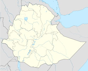
Dera, Ethiopia
| Dera | |
|---|---|
 Dera | |
| Coordinates: 8°20′N 39°19′E / 8.333°N 39.317°ECoordinates: 8°20′N 39°19′E / 8.333°N 39.317°E | |
| Country |
|
| Region | Oromia |
| Zone | Arsi Zone |
| Population (2005) | |
| • Total | 16,731 |
| Time zone | EAT (UTC+3) |
Dera is a town in southeastern Ethiopia. Located in the Arsi Zone of the Oromia Region, this town has a latitude and longitude of 08°20′N 39°19′E / 8.333°N 39.317°E. It is the administrative center of Dodotana Sire woreda.
By the late 1960s, Dera was provided with electricity from a dam on the Awash River. In October 1969, Emperor Haile Selassie inaugurated a water supply system for the town built at a cost of Birr 170,000. The system drew water from the Awash II dam 10 kilometers away.[1] A weekly market is held on Mondays, where grain and livestock can be bought and sold.[2] According to the Oromia Regional government, this town is currently supplied with electricity 24 hours a day, and has telephone service.[3] Construction on the 99 kilometer road between Chole and Dera was completed and opened for traffic 15 August 2009, at a cost of over 146 million Birr. The Ethiopian Roads Authority reported that the new road would reduce the distance between the two towns by ahalf.[4]
On 17 May 1974, an official in Dera had a dispute with local farmers regarding land 7 kilometers away. The official returned with some city men and two police, and a fight with the locals ensued, in which two of the farmers and one of the police were killed. The local police at Asella wanted to occupy the site of the fight and place the inhabitants under military rule. The Governor General of Arsi Province refused to allow them to do this, but was himself soon arrested and removed.[1]
Demographics
Based on figures from the Central Statistical Agency in 2005, Dera has an estimated total population of 16,731, of whom 8,367 are men and 8,364 are women.[5] The 1994 national census reported a total population for this town of 9,356, of whom 4,538 were men and 4,818 women. The three largest ethnic groups reported in Dera were the Oromo (56.78%), the Amhara (37.9%), and the Silt'e (2.62%); all other ethnic groups made up 2.7% of the population. Amharic was spoken as a first language by 50.21%, 46.63% spoke Oromiffa, and 2.04% spoke Silt'e; the remaining 1.12% spoke all other primary languages reported. The majority of the inhabitants were Ethiopian Orthodox Christianity, with 60.5% of the population reporting they observed this belief, while 37.78% of the population said they were Moslem, and 1.51% were Protestant.[6]
Notes
- ↑ 1.0 1.1 "Local History in Ethiopia" The Nordic Africa Institute website (accessed 16 January 2008)
- ↑ "Ethiopian Village Studies: Korodegaga, Dodota, Arssi", p. 3, Centre for the Study of African Economies website (accessed 9 September 2009)
- ↑ Socio-economic profile of Arsi Zone, Government of Oromia Region (last accessed 16 January 2008)
- ↑ "99km Dera-Chole road officially opened for traffic", Ethiopian News Agency, 15 August 2009 (accessed 1 November 2009)
- ↑ CSA 2005 National Statistics, Table B.4
- ↑ 1994 Population and Housing Census of Ethiopia: Results for Oromia Region, Vol. 1, part 1, Tables 2.5, 2.14, 2.17, 2.21 (accessed 6 April 2009)