Dent de Lys
From Wikipedia, the free encyclopedia
| Dent de Lys | |
|---|---|
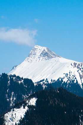
 View from Les Pléiades (west side) | |
| Elevation | 2,014 m (6,608 ft) |
| Prominence | 502 m (1,647 ft)[1] |
| Parent peak | Rochers de Naye |
| Location | |
 Dent de Lys | |
| Location | Fribourg, Switzerland |
| Range | Bernese Alps |
| Coordinates | 46°30′27.5″N 7°0′10.6″E / 46.507639°N 7.002944°ECoordinates: 46°30′27.5″N 7°0′10.6″E / 46.507639°N 7.002944°E |
The Dent de Lys is a mountain in the Bernese Alps, overlooking the valley of Gruyère in the Swiss canton of Fribourg.
The closes localitie are Les Paccots (west) and Montbovon (east). The summit can be reached by a trail starting at the Col de Lys.
References
External links
This article is issued from Wikipedia. The text is available under the Creative Commons Attribution/Share Alike; additional terms may apply for the media files.