Debre Marqos
| Debre Marqos ደብረ ማርቆስ | |
|---|---|
 | |
 Debre Marqos | |
| Coordinates: 10°20′N 37°43′E / 10.333°N 37.717°E | |
| Country | Ethiopia |
| Region | Amhara Region |
| Zone | Misraq Gojjam Zone |
| Elevation | 2,446 m (8,025 ft) |
| Population (2007) | |
| • Total | 62,497 |
| Time zone | EAT (UTC+3) |
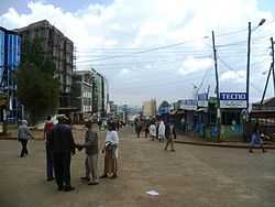
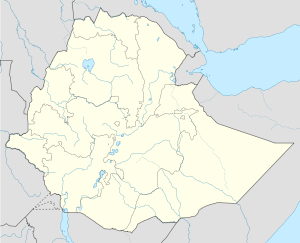
Debre Marqos (also called Mankorar) is a city and woreda in east-central Ethiopia. Located in the Misraq Gojjam Zone of the Amhara Region, it has a latitude and longitude of 10°20′N 37°43′E / 10.333°N 37.717°ECoordinates: 10°20′N 37°43′E / 10.333°N 37.717°E, and an elevation of 2,446 meters. The city is named Debre Marqos after its principal church, which was constructed in 1869 and dedicated to St. Mark.[1] Until the reorganization of the provinces that followed the adoption of the 1995 constitution, this city served as the capital of the province of Gojjam.
Debre Marqos is served by an airport (ICAO code HADM, IATA DBM) with an unpaved runway.
History
The palace of Negus Tekle Haymanot was remodeled in 1926 by his son Ras Hailu Tekle Haymanot, in the style of European buildings after his tour of Europe in the party of Ras Tefari. By 1935, the town had postal, telegraph, and telephone service.[1]
The Italians arrived in Debre Marqos 20 May 1936. Through an interpreter, Achille Starace, who had arrived by plane, told the surprised local inhabitants that he had come free them from their oppressors, to their thorough bemusement. Debre Marqos was later isolated, and practically besieged by a revolt in 1938. General Ugo Cavallero, with sixty thousand men and supported by airplanes and tanks, had crushed the revolt by the end of May.[1] A major Italian fortification was located in the city during the existence of Italian East Africa, and captured by the British Gideon Force and Ethiopian Arbegnoch (or Resistance Fighters) 3 April 1941 during the East African Campaign.
In 1957, Negus Tekle Haimanot School in Debre Marqos was one of 9 provincial secondary schools in Ethiopia. The next year, the town was one of 27 places in Ethiopia ranked as a First Class Township. In 1960 a branch of the Ethiopian Electric Light and Power Authority had started operation in Debre Marqos.[1]
Construction on Africa's first electric bus manufacturing factory began on 43 hectares of land in Debre Marqos in January, 2007 by Rus Afro Trolleybus, a joint Russian-Ethiopian partnership. CEO and major shareholder Getachew Eshetu has predicted that the factory will have the capacity to manufacture 500 trolley buses per year, and employ 5,000 people.[2]
The Debre Markos University was opened in 2007.
Demographics
Based on the 2007 national census conducted by the Central Statistical Agency of Ethiopia (CSA), this town has a total population of 62,497, of whom 29,921 are men and 32,576 women. The majority of the inhabitants practiced Ethiopian Orthodox Christianity, with 97.03% reporting that as their religion, while 1.7% of the population said they were Muslim and 1.1% were Protestants.[3]
The 1994 national census reported a total population for Debre Marqos of 49,297 in 9,617 households, of whom 22,745 were men and 26,552 were women. The three largest ethnic groups reported in this town were the Amhara (97.12%), the Tigrayan (1.29%), and the Oromo (0.67%); all other ethnic groups made up 0.92% of the population. The majority of the inhabitants practiced Ethiopian Orthodox Christianity, with 97.25% reporting that as their religion, while 1.88% were Muslim, and 0.81% were Protestant.[4]
Notes
- ↑ 1.0 1.1 1.2 1.3 "Local History in Ethiopia" The Nordic Africa Institute website (accessed 6 December 2007)
- ↑ "Trolley Bus Manufacturing Factory to be established in Ethiopia" (Nazret.com, reprinted from the Ethiopian Herald 15 November 2006); "Ethiopia - Trolley bus Factory in Debre Markos on track" (Nazret.com, published 26 June 2006)
- ↑ Census 2007 Tables: Amhara Region, Tables 2.1, 2.4, 2.5, 3.1, 3.2 and 3.4.
- ↑ 1994 Population and Housing Census of Ethiopia: Results for Amhara Region, Vol. 1, part 1, Tables 2.1, 2.7, 2.10, 2.17, Annex II.2 (accessed 9 April 2009)
| |||||||
