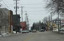
Dale (CDP), Wisconsin
From Wikipedia, the free encyclopedia
| Dale | |
|---|---|
| Census-designated place | |
 | |
| Coordinates: 44°16′23″N 88°40′42″W / 44.27306°N 88.67833°WCoordinates: 44°16′23″N 88°40′42″W / 44.27306°N 88.67833°W | |
| Country | United States |
| State | Wisconsin |
| County | Outagamie |
| Area | |
| • Total | 1.492 sq mi (3.86 km2) |
| • Land | 1.492 sq mi (3.86 km2) |
| • Water | 0 sq mi (0 km2) |
| Elevation[1] | 814 ft (248 m) |
| Population (2010) | |
| • Total | 528 |
| • Density | 350/sq mi (140/km2) |
| Time zone | Central (CST) (UTC-6) |
| • Summer (DST) | CDT (UTC-5) |
| ZIP Codes | 54931 |
| Area code(s) | 920 |
| FIPS code | Class Code U6[1] |
| GNIS feature ID | 1563669[1] |
Dale is an unincorporated census-designated place in the town of Dale in Outagamie County, Wisconsin, United States. It is located at the intersection of Wisconsin Highway 96 and County T.[2] As of the 2010 census, its population was 528.[3]
-

Post office
-

Entrance sign
-

Town hall for the town of Dale
References
- ↑ 1.0 1.1 1.2 "Dale, Wisconsin". Wisconsin Hometown Locator. Retrieved 20 April 2010.
- ↑ "Location of Dale". Mapquest. Retrieved 20 April 2010.
- ↑ "American FactFinder". U.S. Census Bureau. Retrieved 30 March 2011.
| |||||||||||||||||||||||||||||
This article is issued from Wikipedia. The text is available under the Creative Commons Attribution/Share Alike; additional terms may apply for the media files.
