Dadu District
| Dadu District ضلع دادُو ضلعو دادو | |
|---|---|
| District | |
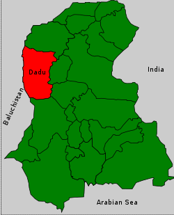 | |
| Country | Pakistan |
| Province | Sindh |
| Capital | Dadu |
| Government | |
| • District Nazim | Karim Ali Jatoi |
| • District Naib Nazim | Ali Muhammad Soomro |
| Area | |
| • Total | 19,070 km2 (7,360 sq mi) |
| Population (1998) | |
| • Total | 1,688,811 |
| • Density | 89/km2 (230/sq mi) |
| Time zone | PST (UTC+5) |
| Area code(s) | 025 |
| Number of Tehsils | 4 |
Dadu (Sindhi: دادو), (Urdu: دادو) is a district of Sindh Province, Pakistan. Dadu District was created in 1933 by the British Indian administration by merging Kotri and Kohistan tehsils from Karachi District and Mehar, Khairpur Nathan Shah, Dadu, Johi and Sehwan tehsils from Larkana District. The population of the district is 1,688,810 according to a 1998 census report. The rural and urban population of the district constitutes 79% and 21% of the total population respectively. The area of district is 19,070 square kilometers divided in seven talukas yielding population density of 88.6 persons per square kilometre. The average household size of the district is 5.5 persons, and 6.3 in urban areas. More than 73% of the housing units in Dadu District are single room houses. The average annual rainfall in the district is about 120 millimeters. The total forested area is 217,000 hectares yielding timber and firewood. In 2004 another district by the name of Jamshoro was carved out of Dadu District which comprised Taluka Kotri, Taluka Sehwan and Taluka Jamshoro, the headquarter of the new district.
Tribes and clans
The majority of the population are Muslims that mainly consists of Sindhi and Baloch tribes. The Sindhi tribes include:
Bughio,Rahuja , Abbasi , Brohi , Chandio , Malik , Malak, Channa (Sindhi tribe), Sario, Birhmani, Ansari, Arain, Lakhiar, Langah, Gilal, Dero , Soomro, Palh, Dawachh,Joyo, Panhwar, Mahesar, Solangi, Qadi, Shah, Mirani, Babar, Mallah, Abro, Vighio, Mohana, Ranjhani, Khero, Khaharo, Unar, Bahota, Chandoor Charan, Memon, Abbasi, Bhati, Mughal, Lakhmir, Johiya, Janwari, Qureshi, Rustamani, Hingoro, Rajput, Khatti, Jaisar, Kingrani, Akhund and others. The Baloch tribes include: , Korai, Jamali, Shahani, Gabol, Lund, Magsi, Khushk, Bozdar, Leghari, Rodnani, Rind and Khoso tribes.[1]
Demographics
Following are the demographic indicators of the district as per the 1998 census of Pakistan (including Jamshoro District which was a part of Dadu at the time):
Religion
- Islam: 97.49%
- Hinduism: 2.05%
- Christianity: 0.37%
- Ahmaddiya: 0.08%
- Others: 0.02%
Hindus and Christians are mainly concentrated in the urban areas.[1]
Languages
Note: This list only sums to 97.08%, there may be languages unaccounted for.
Urdu speakers are mainly concentrated in the urban areas.
Talukas (tehsils)
- Mehar Taluka
- Khairpur Nathan Shah Taluka
- Dadu Taluka
- Johi Taluka[1]
Places of interest
- Gorakh Hill - First hill station in Sindh
- Manchar Lake - Largest lake in Pakistan and one of the largest lakes in Asia
-

Largest Lake in Asia, Manchar

See also
References
- ↑ 1.0 1.1 1.2 1.3 Dadu, District. "Dadu City Layout". Dadu City Local Government. Retrieved 8 November 2013.
External links
Coordinates: 26°20′N 67°35′E / 26.333°N 67.583°E