D28 road (Croatia)
From Wikipedia, the free encyclopedia
| |
|---|---|
| Route information | |
| Length: | 70.7 km (43.9 mi) |
| Major junctions | |
| From: | D10 in Gradec interchange |
|
| |
| To: |
|
| Location | |
| Counties: | Bjelovar-Bilogora, Koprivnica-Križevci, Zagreb County |
| Major cities: | Vrbovec, Bjelovar |
| Highway system | |
| State roads in Croatia | |

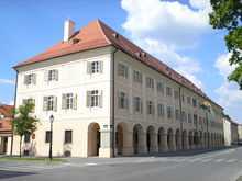
Bjelovar, on the D28 road route
D28 is a state road in the central Croatia connecting the D5 in Veliki Zdenci to the D10 in Gradec interchange.[maps 1] The road is 70.7 km (43.9 mi) [1] The road, as well as all other state roads in Croatia, is managed and maintained by Hrvatske ceste, a state-owned company.[2]
Traffic volume
Traffic is regularly counted and reported by Hrvatske ceste, one of the operators of the road.[3]
| D28 traffic volume | ||||
| Road | Counting site | AADT | ASDT | Notes |
| |
2103 Sveti Ivan Žabno | 7,789 | 8,031 | Adjacent to the Ž3041 junction. |
| |
2102 Predavac | 9,227 | 9,219 | Adjacent to the D524 junction. |
| |
2106 Prespa | 5,314 | 4,769 | Adjacent to the Ž3048 junction. |
| |
2110 Bulinac | 2,399 | 2,495 | Adjacent to the Ž3090 junction. |
Road junctions and populated areas
| D28 junctions/populated areas | |
| Type | Slip roads/Notes |
| |
Gradec interchange D10 to Sveta Helena, Zagreb County interchange (A4). Ž3052 to Vrbovec. The western terminus of the road. |
| |
Cugovec Ž3052 to Vrbovec (D41). |
| |
Haganj Ž3041 to Dubrava, Ivanić Grad, Veleševec, Novo Čiče and the D30 state road. |
| |
Škrinjari |
| |
Sveti Ivan Žabno Ž2229 to Brezovljani. Ž2230 to Cirkvena. |
| |
Kuštani |
| |
Kenđelovec Ž2231 to Cirkvena, Farkaševac and the D43 state road. |
| |
Markovac Križevački |
| |
Rovišće Ž3003 to Kraljevac. Ž3020 to Tuk. |
| |
Predavac Ž3021 to Žabljak. Ž3022 to Diebali. Ž3023 to Klokočevac. |
| |
Bjelovar Ž2143 to Novi Skucani and Zrinski Topolovac. Ž3044 within the city. Ž3043 to Stare Plavnice. Ž3045 to Galovac and Nevinac. Ž3046 to Novoseljani. Ž3047 to Ždralovi. |
| |
Ž3048 to Tomaš. |
| |
Prespa |
| |
Ž3088 to Ciglena. |
| |
Severin |
| |
Ž3090 to Nova Rača, Velika Trnovitica, Veliki Pašijan (D26). |
| |
Bulinac Ž2232 to Šandrovac, Suha Katalena and Budančevica (D2). |
| |
Drljanovac Ž3280 to Nova Rača. |
| |
Ž4002 to Velika Pisanica, Velika Črešnjevica and Pitomača (D2). |
| |
Veliki Grđevac Ž3092 to Donja Kovačica, Slovinska Kovačica and Orlovac. Ž3093 to Gornja Kovačica and Velika Barna. Ž3094 to Grubišno Polje (D5). |
| |
Pavlovac Ž3133 to Ladislav and to (D45). |
| |
Veliki Zdenci The eastern terminus of the road. |
Maps
- ↑ OpenStreetMap. Overview map of the D28 (Map). http://www.openstreetmap.org/?relation=1226494. Retrieved September 10, 2013.
Sources
- ↑ Ministry of Sea, Transport and Infrastructure (Croatia) (June 4, 2013). "Decision on categorization of public roads as state roads, county roads and local roads" (in Croatian). Narodne novine. Retrieved September 5, 2013.
- ↑ "Public Roads Act". Narodne novine (in Croatian). December 14, 2004.
- ↑ "Traffic counting on the roadways of Croatia in 2009 - digest". Hrvatske ceste. May 1, 2010.
| ||||||||||||||||||||||||||
This article is issued from Wikipedia. The text is available under the Creative Commons Attribution/Share Alike; additional terms may apply for the media files.