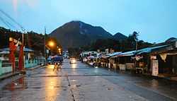
Cuenca is a fourth class municipality in the province of Batangas, Philippines. According to the 2010 census, it has a population of 31,236 people.[3]
Once a part of San Jose, it became an independent town under the name of "Cuenca" in 1876. Its famous tourist attraction is the 600 metres (2,000 ft) high Mount Maculot.
The Patron of Cuenca is Saint Isidore the Laborer, the patron of farmers celebrates his feast day during May. 15
History
Cuenca was founded in 1875 by the decree of the Superior Gobierno issued on August 11, 1875. Another document states the barrios of Maculot, Dita, Ibabao, Labac, Bungahan and Dalipit be constituted into one civil and independent town due to its distance from the town of San Jose.

Parish of San Isidro Labrador
In 1896, Cuenca had a population of 5,660, which increased to 6,938 in 1898. The town also played a role during World War II. Mt. Maculot became the stronghold of the Japanese forces in Batangas. They also built tunnels in some parts of Barangay Dita. During the Liberation, Cuenca was badly bombed which cause the deforestation of the slopes of the mountain. Rehabilitation was needed in order for the town to rise up from the ruins of the war. Local Filipino troops and officers of the 4th, 42nd and 45th Infantry Division of the Philippine Commonwealth Army and 4th Infantry Regiment of the Philippine Constabulary enters the liberated in Cuenca in 1944 to 1945 and helpul the local guerrilla resistance fighters and American liberation forces against the Japanese. Combined Filipino-American ground forces helped the town by rebuilding schools and bridges. A marker in Cuenca Central Elem. School shows the effort they did. Cuenca Institute was founded in 1947 in order to give secondary education and it is the oldest secondary institution in Cuenca. Back then, students who graduated elementary used to go to Batangas City or Manila and parents who could not afford to send their children to those places failed to give them a high school education. Cuenca became popular not only because of the mountain but to its number of bakers. In Manila, over 90% of all bakers come and started here, making Cuenca as "The Home Of The Bakers". Annually, festivals are made in honor of San Isidro Labrador.
Barangays
Cuenca is politically subdivided into 21 barangays.[2] Don Juan was constituted as a barrio in 1954 from the sitios of Lungos ng Parang, Kulit, Lumampao, Pisa, Napapanayam and Lagundian.[4]
- Balagbag
- Bungahan
- Calumayin
- Dalipit East
- Dalipit West
- Dita
- Don Juan
- Emmanuel
- Ibabao
- Labac
- Pinagkaisahan
- San Felipe
- San Isidro
- Barangay 1 (Pob.)
- Barangay 2 (Pob.)
- Barangay 3 (Pob.)
- Barangay 4 (Pob.)
- Barangay 5 (Pob.)
- Barangay 6 (Pob.)
- Barangay 7 (Pob.)
- Barangay 8 (Pob.)
Demographics

Cuenca town hall
| Population census of Cuenca |
|---|
| Year |
Pop. | ±% p.a. |
|---|
| 1990 |
20,176 | — |
| 1995 |
22,758 | +2.44% |
| 2000 |
25,642 | +2.41% |
| 2007 |
28,581 | +1.56% |
| 2010 |
31,236 | +3.01% |
| Source: National Statistics Office[3] |
References
External links


.svg.png)


