County of Moira
From Wikipedia, the free encyclopedia
| Moira Victoria | |||||||||||||
|---|---|---|---|---|---|---|---|---|---|---|---|---|---|
 Location in Victoria | |||||||||||||
| |||||||||||||
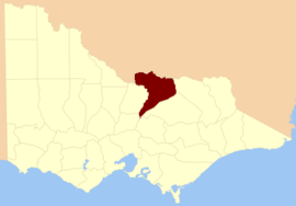
The County of Moira is one of the 37 counties of Victoria which are part of the cadastral divisions of Australia, used for land titles. It is located to the east of the Goulburn River, south of the Murray River, and west of part of the Ovens River. Part of Wangaratta is in the county, on the eastern end of it. It also includes Shepparton. The Shire of Moira is in a similar area.
Parishes
Parishes within the county:
- Arcadia, Victoria
- Avenel, Victoria
- Balmattum, Victoria
- Barmah, Victoria
- Barwo, Victoria
- Baulkamaugh, Victoria
- Benalla, Victoria
- Boomahnoomoonah, Victoria
- Boosey, Victoria
- Boweya, Victoria
- Branjee, Victoria
- Bundalong, Victoria
- Bunganail, Victoria
- Bungeet, Victoria
- Burramine, Victoria
- Caniambo, Victoria
- Cobram, Victoria
- Cocomah, Victoria
- Congupna, Victoria
- Currawa, Victoria
- Dargalong, Victoria
- Devenish, Victoria
- Dookie, Victoria
- Drumanure, Victoria
- Dunbulbalane, Victoria
- Euroa, Victoria
- Glenrowen, Victoria
- Goomalibee, Victoria
- Goorambat, Victoria
- Gowangardie, Victoria
- Kaarimba, Victoria
- Karrabumet, Victoria
- Karramomus, Victoria
- Katamatite, Victoria
- Katandra, Victoria
- Katunga, Victoria
- Kialla, Victoria
- Killawarra, Victoria
- Kotupna, Victoria
- Longwood, Victoria
- Miepoll, Victoria
- Moglonemby, Victoria
- Moira, Victoria
- Mokoan, Victoria
- Molka, Victoria
- Monea North, Victoria
- Mundoona, Victoria
- Naringaningalook, Victoria
- Narioka, Victoria
- Peechelba, Victoria
- Pelluebla, Victoria
- Picola, Victoria
- Pine Lodge, Victoria
- Pranjip, Victoria
- Shadforth, Victoria
- Shepparton, Victoria
- St James, Victoria
- Stewarton, Victoria
- Strathmerton, Victoria
- Tabilk, Victoria
- Tallygaroopna, Victoria
- Taminick, Victoria
- Tamleugh, Victoria
- Tharanbegga, Victoria
- Ulupna, Victoria
- Upotipotpon, Victoria
- Waaia, Victoria
- Waggarandall, Victoria
- Wahring, Victoria
- Wangaratta South, Victoria
- Warrenbayne, Victoria
- Wills, Victoria
- Winton, Victoria
- Wormangal, Victoria
- Yabba Yabba, Victoria
- Yalca, Victoria
- Yarrawonga, Victoria
- Yarroweyah, Victoria
- Yielima, Victoria
- Youanmite, Victoria
- Youarang, Victoria
References
Coordinates: 36°25′S 145°40′E / 36.417°S 145.667°E
This article is issued from Wikipedia. The text is available under the Creative Commons Attribution/Share Alike; additional terms may apply for the media files.