Cougar Ridge, Calgary
From Wikipedia, the free encyclopedia
| Cougar Ridge | |
|---|---|
| Neighbourhood | |
 | |
| Coordinates: 51°04′19″N 114°12′12″W / 51.07194°N 114.20333°W | |
| Country |
|
| Province |
|
| City |
|
| Quadrant | SW |
| Ward | 6 |
| Established | 2001 |
| Annexed | 1995 |
| Government[1] | |
| • Mayor | Naheed Nenshi |
| • Administrative body | Calgary City Council |
| • Councillor | Richard Pootmans |
| Elevation | 1,235 m (4,052 ft) |
| Population (2006)[2] | |
| • Total | 4,375 |
| • Average Income | $100,908 |
| Postal code | T3H |
| Website | Cougar Ridge Community Association |
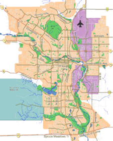
Cougar Ridge is a residential neighbourhood in the south-west quadrant of Calgary, Alberta. It is located at the western edge of the city and is bounded by Paskapoo Slopes and Canada Olympic Park to the north, 69 Street W to the east, 101 Street W to the west and Old Banff Coach Road to the south.
It is represented in the Calgary City Council by the Ward 6 councillor.[1]
Demographics
In the City of Calgary's 2012 municipal census, Cougar Ridge had a population of 5,874 living in 1,908 dwellings, a 1% increase from its 2011 population of 5,813.[3] With a land area of 2.2 km2 (0.85 sq mi), it had a population density of 2,670/km2 (6,920/sq mi) in 2012.[4][3]
See also
References
- ↑ 1.0 1.1 "Calgary Elections". City of Calgary. October 21, 2013. Retrieved October 22, 2013.
- ↑ City of Calgary (2006). "Cougar Ridge Community Statistics". Retrieved 2007-05-23.
- ↑ 3.0 3.1 "2012 Civic Census Results". City of Calgary. 2012. Retrieved February 4, 2013.
- ↑ "Community Boundaries" (Esri shapefile). City of Calgary. Retrieved February 5, 2013.
External links
- Federation of Calgary Communities. "Cougar Ridge Community". Retrieved 2007-05-13.
 |
Canada Olympic Park | Bowness | Bow River |  |
| Rocky View County | |
Patterson | ||
| ||||
| | ||||
| Springbank | West Springs | Coach Hill |
Coordinates: 51°04′19″N 114°12′12″W / 51.07194°N 114.20333°W
This article is issued from Wikipedia. The text is available under the Creative Commons Attribution/Share Alike; additional terms may apply for the media files.