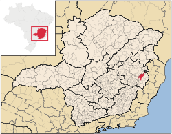
Conselheiro Pena
From Wikipedia, the free encyclopedia
| Conselheiro Pena | |
|---|---|
 | |
| Country | Brazil |
| Region | Southeast |
| State | Minas Gerais |
| Incorporated | December 17, 1938 |
| Government | |
| • Mayor | Neyval Jose de Andrade |
| Area | |
| • Total | 1,408.017 km2 (543.638 sq mi) |
| Population (est. 2006) | |
| • Total | 20,492 |
| • Density | 14.6/km2 (38/sq mi) |
| Time zone | UTC-3 (UTC-3) |
| • Summer (DST) | UTC-2 (UTC-2) |
| Website | Official website |
Coordinates: 19°10′S 41°28′W / 19.167°S 41.467°W
Conselheiro Pena, formerly known as "Lajao", is located in the state of Minas Gerais, Brazil. This town of 20,000 inhabitants, was formed alongside the "Rio Doce", or Sweet River.
This article is issued from Wikipedia. The text is available under the Creative Commons Attribution/Share Alike; additional terms may apply for the media files.