Coldharbour, Havering
| Coldharbour | |
 Coldharbour Point on the River Thames |
|
 Coldharbour | |
| OS grid reference | TQ525785 |
|---|---|
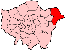
| London borough | Havering |
| Ceremonial county | Greater London |
| Region | London |
| Country | England |
| Sovereign state | United Kingdom |
| Post town | RAINHAM |
| Postcode district | RM13 |
| Dialling code | 01708 |
| Police | Metropolitan |
| Fire | London |
| Ambulance | London |
| EU Parliament | London |
| UK Parliament | Dagenham and Rainham |
| London Assembly | Havering and Redbridge |
Coldharbour is a district of the London Borough of Havering, adjacent to the River Thames, in London, England. It is the location of Coldharbour Point, where there has been a lighthouse since 1885. It is on the route of the London Outer Orbital Path. A ferry operated from Coldharbour Point to Erith on the southern bank of the Thames from the Middle Ages until the end of the 19th century.
History
Coldharbour was an estate primarily in the ancient parish of Wennington. It included Little Coldharbour (also partly in Rainham), Coldharbour Point and Great Coldharbour. It was originally a marsh island.[1]
A River Thames ferry (known as the 'short ferry' in contrast to the 'long ferry' to London) operating from Erith in Kent to Coldharbour Point existed from the Middle Ages until the 19th century. Plaques entitled 'Pilgrim Ferry' commemorates this in Coldharbour and Erith.
References
| |||||||||||||||||||||||||