Col


A col in the geographic (as opposed to meteorological) sense is a geomorphological term referring to the lowest point on a mountain ridge between two peaks.[1] It may also be called a notch, a gap or a saddle,[1] although the last-named usually has a wider meaning and may contain a mountain pass. The height of a summit above its highest col (called the key col) is effectively a measure of a mountain's prominence, an important measure of the independence of its summit. Cols lie on the line of the watershed between two mountains, often on a prominent ridge or arête.
Particularly rugged and forbidding cols in the terrain are usually referred to as notches. They are generally unsuitable as mountain passes, but are occasionally crossed by mule tracks or climbers' routes.
For example, the highest col in Austria, the Obere Glocknerscharte ("Upper Glockner Col", 3,766 m AA), lies between the Kleinglockner (3,783 m AA) and Großglockner (3,798 m AA) mountains, giving the Kleinglockner a minimum prominence of 17 metres. The notch is about 8 metres wide and links the two peaks with a usually corniced, often only two foot wide, narrow, snow-covered ridge. The col is on the normal climbing route from the Adlersruhe to the summit of the Großglockner; it acts as the exit from the Pallavicini Couloir (Pallavicini-Rinne) (an ice gully lying at up to 55 ° to the horizontal) from the north and has never been climbed from the south. Hardly anyone has ever considered crossing the Glockner massif via this col.[2]
The overwhelming majority of cols are, however, unnamed and are either never transited or only crossed in the course of negotiating a ridge line. For example, every Gratturm ("ridge pinnacle", e.g. the Gendarm) has a col. Many double summits are separated by prominent cols. The number of cols gave rise to the name of the Lyskamm (Lauskamm).
The distinction with other names for breaks in mountain ridges such as saddle, wind gap or notch is not sharply defined and may vary from place to place.

Other well-known cols are:
- South Col between Mount Everest and Lhotse
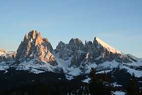
- Langkofel Col (Langkofelscharte) in the Langkofel Group
- The notches of the Peuterey ridge on Mont Blanc
- Hohe Dachsteinscharte (2,874 m AA) between the Hoher and Niederer Dachstein.
- the cols between the five points above 4,000 metres on the ridge of Teufelsgrat on the Mont Blanc du Tacul
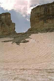
- Brèche de Roland in the Pyrenees
See also
References
- ↑ 1.0 1.1 Whittow, John (1984). Dictionary of Physical Geography. London: Penguin, 1984, p. 103. ISBN 0-14-051094-X.
- ↑ Willi End, Hubert Peterka: Alpenvereinsführer Glockner- und Granatspitzgruppe, Bergverlag Rudolf Rother, Munich, 1990. ISBN 3-7633-1258-7