Clinton, Ohio
| Clinton, Ohio | |
|---|---|
| Village | |
 | |
 | |
| Coordinates: 40°55′24″N 81°37′59″W / 40.92333°N 81.63306°WCoordinates: 40°55′24″N 81°37′59″W / 40.92333°N 81.63306°W | |
| Country | United States |
| State | Ohio |
| County | Summit |
| Area[1] | |
| • Total | 3.64 sq mi (9.43 km2) |
| • Land | 3.55 sq mi (9.19 km2) |
| • Water | 0.09 sq mi (0.23 km2) |
| Elevation[2] | 948 ft (289 m) |
| Population (2010)[3] | |
| • Total | 1,214 |
| • Estimate (2012[4]) | 1,212 |
| • Density | 342.0/sq mi (132.0/km2) |
| Time zone | Eastern (EST) (UTC-5) |
| • Summer (DST) | EDT (UTC-4) |
| ZIP code | 44216 |
| Area code(s) | 330 |
| FIPS code | 39-16182[5] |
| GNIS feature ID | 1057275[2] |
| Website | http://www.clintonoh.org |
Clinton is a village in Summit County, Ohio, United States. The population was 1,214 at the 2010 Census. It is part of the Akron Metropolitan Statistical Area.
History
Clinton was formerly known as Warwick, and that name is still used for the rail junction.
The village was laid out in 1816. Growth accelerated upon the arrival of the Ohio and Erie Canal. The arrival of the railroad in the 1880s, put the canal, which was then in need of costly repairs, out of business. A major flood in 1913 required that the remaining canal locks be destroyed.
Geography
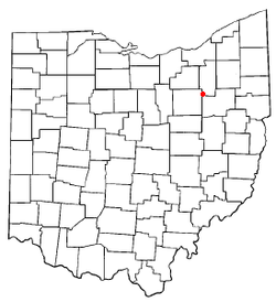
Clinton is located at 40°55′24″N 81°37′59″W / 40.92333°N 81.63306°W (40.923388, -81.633088),[6] along the Tuscarawas River.[7]
According to the United States Census Bureau, the village has a total area of 3.64 square miles (9.43 km2), of which, 3.55 square miles (9.19 km2) is land and 0.09 square miles (0.23 km2) is water.[1]
Demographics
2010 census
According to the 2010 Census, there were 1,214 people, 471 households, and 345 families residing in Clinton. The population density was 342.0 inhabitants per square mile (132.0 /km2). There were 535 housing units at an average density of 150.7 per square mile (58.2 /km2). The racial makeup of the village was 97.5% White, 0.3% African American, 0.2% Native American, 0.3% Asian, 0.2% from other races, and 1.3% from two or more races. Hispanic or Latino of any race were 0.7% of the population.[3]
There were 471 households of which 31.0% had children under the age of 18 living with them, 58.4% were married couples living together, 7.6% had a female householder with no husband present, 7.2% had a male householder with no wife present, and 26.8% were non-families. 21.4% of all households were made up of individuals and 7.9% had someone living alone who was 65 years of age or older. The average household size was 2.58 and the average family size was 2.98.
The median age in the village was 43.1 years. 21.4% of residents were under the age of 18; 9% were between the ages of 18 and 24; 22.5% were from 25 to 44; 33.8% were from 45 to 64; and 13.3% were 65 years of age or older. The gender makeup of the village was 51.6% male and 48.4% female.
2000 census
According to the 2000 Census, there were 1,337 people, 496 households, and 380 families residing in the village. The population density was 376.2 people per square mile (145.4/km²). There were 528 housing units at an average density of 148.6 per square mile (57.4/km²). The racial makeup of the village was 97.68% White, 0.37% African American, 0.15% Native American, 0.45% Asian, 0.22% from other races, and 1.12% from two or more races. Hispanic or Latino of any race were 0.37% of the population.[5]
There were 496 households out of which 34.1% had children under the age of 18 living with them, 66.3% were married couples living together, 7.7% had a female householder with no husband present, and 23.2% were non-families. 19.8% of all households were made up of individuals and 9.1% had someone living alone who was 65 years of age or older. The average household size was 2.69 and the average family size was 3.12.
In the village the population was spread out with 25.4% under the age of 18, 8.2% from 18 to 24, 29.9% from 25 to 44, 25.2% from 45 to 64, and 11.3% who were 65 years of age or older. The median age was 37 years. For every 100 females there were 103.5 males. For every 100 females age 18 and over, there were 96.5 males.
The median income for a household in the village was $49,353, and the median income for a family was $53,438. Males had a median income of $38,047 versus $26,250 for females. The per capita income for the village was $23,063. About 3.6% of families and 4.9% of the population were below the poverty line, including 7.0% of those under age 18 and 6.4% of those age 65 or over.
References
- ↑ 1.0 1.1 "US Gazetteer files 2010". United States Census Bureau. Retrieved 2013-01-06.
- ↑ 2.0 2.1 "US Board on Geographic Names". United States Geological Survey. 2007-10-25. Retrieved 2008-01-31.
- ↑ 3.0 3.1 "American FactFinder". United States Census Bureau. Retrieved 2013-01-06.
- ↑ "Population Estimates". United States Census Bureau. Retrieved 2013-06-17.
- ↑ 5.0 5.1 "American FactFinder". United States Census Bureau. Retrieved 2008-01-31.
- ↑ "US Gazetteer files: 2010, 2000, and 1990". United States Census Bureau. 2011-02-12. Retrieved 2011-04-23.
- ↑ DeLorme (1991). Ohio Atlas & Gazetteer. Yarmouth, Maine: DeLorme. ISBN 0-89933-233-1.
External links
| ||||||||||||||||||||||||||
