Claxheugh
From Wikipedia, the free encyclopedia
Coordinates: 54°54′36″N 1°26′10″W / 54.910°N 1.436°W<th scope="row" style="text-align:left;"FONT-WEIGHT: bold;";">OS grid reference
| Claxheugh | |
|---|---|
 <div style=""font-size:small;";">Claxheugh Rock | |
 Claxheugh | |
| NZ362574 | |
| List of places: UK • England • Tyne and Wear | |
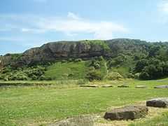
Claxheugh (/ˈklætʃəf/ KLACH-əf) is an area of South Hylton, Sunderland, Tyne and Wear, England. The area is primarily known for the large, limestone and sandstone cliff formed in the late Permian period, known as Claxheugh Rock, which forms part of the Ford Formation. The rock is often referred to as 'klachy rock' by the locals.
| |||||||||||||||||
This article is issued from Wikipedia. The text is available under the Creative Commons Attribution/Share Alike; additional terms may apply for the media files.