Clarington, Ohio
| Clarington, Ohio | |
|---|---|
| Village | |
 | |
| Coordinates: 39°46′22″N 80°52′5″W / 39.77278°N 80.86806°WCoordinates: 39°46′22″N 80°52′5″W / 39.77278°N 80.86806°W | |
| Country | United States |
| State | Ohio |
| County | Monroe |
| Area[1] | |
| • Total | 1.24 sq mi (3.21 km2) |
| • Land | 1.14 sq mi (2.95 km2) |
| • Water | 0.10 sq mi (0.26 km2) |
| Elevation[2] | 633 ft (193 m) |
| Population (2010)[3] | |
| • Total | 384 |
| • Estimate (2012[4]) | 382 |
| • Density | 336.8/sq mi (130.0/km2) |
| Time zone | Eastern (EST) (UTC-5) |
| • Summer (DST) | EDT (UTC-4) |
| ZIP code | 43915 |
| Area code(s) | 740 |
| FIPS code | 39-15210[5] |
| GNIS feature ID | 1056805[2] |
Clarington is a village on the Ohio River in Monroe County, Ohio, United States. The population was 384 at the 2010 census.[6]
Clarington is served by the Monroe County District Library from its administrative offices in Woodsfield, Ohio.
History
Clarington was described in 1833 as having two stores, one tavern, one physician and ten residential houses.[7]
Geography
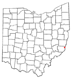
Clarington is located at 39°46′22″N 80°52′5″W / 39.77278°N 80.86806°W (39.772655, -80.868008).[8]
According to the United States Census Bureau, the village has a total area of 1.24 square miles (3.21 km2), of which, 1.14 square miles (2.95 km2) is land and 0.10 square miles (0.26 km2) is water.[1]
Demographics
2010 census
As of the census[3] of 2010, there were 384 people, 165 households, and 107 families residing in the village. The population density was 336.8 inhabitants per square mile (130.0 /km2). There were 186 housing units at an average density of 163.2 per square mile (63.0 /km2). The racial makeup of the village was 96.9% White, 1.0% African American, and 2.1% from two or more races. Hispanic or Latino of any race were 0.3% of the population.
There were 165 households of which 29.1% had children under the age of 18 living with them, 42.4% were married couples living together, 16.4% had a female householder with no husband present, 6.1% had a male householder with no wife present, and 35.2% were non-families. 32.1% of all households were made up of individuals and 13.9% had someone living alone who was 65 years of age or older. The average household size was 2.33 and the average family size was 2.88.
The median age in the village was 40.3 years. 23.4% of residents were under the age of 18; 8.9% were between the ages of 18 and 24; 24.2% were from 25 to 44; 28.1% were from 45 to 64; and 15.4% were 65 years of age or older. The gender makeup of the village was 44.5% male and 55.5% female.
2000 census
As of the census[5] of 2000, there were 444 people, 182 households, and 125 families residing in the village. The population density was 397.3 people per square mile (153.1/km²). There were 209 housing units at an average density of 187.0 per square mile (72.0/km²). The racial makeup of the village was 99.10% White, 0.68% African American, and 0.23% from two or more races. Hispanic or Latino of any race were 0.68% of the population.
There were 182 households out of which 28.6% had children under the age of 18 living with them, 51.6% were married couples living together, 12.1% had a female householder with no husband present, and 30.8% were non-families. 23.6% of all households were made up of individuals and 15.4% had someone living alone who was 65 years of age or older. The average household size was 2.44 and the average family size was 2.89.
In the village the population was spread out with 23.0% under the age of 18, 6.8% from 18 to 24, 28.2% from 25 to 44, 23.9% from 45 to 64, and 18.2% who were 65 years of age or older. The median age was 40 years. For every 100 females there were 89.7 males. For every 100 females age 18 and over, there were 86.9 males.
The median income for a household in the village was $28,281, and the median income for a family was $31,875. Males had a median income of $30,750 versus $20,938 for females. The per capita income for the village was $13,730. About 21.4% of families and 25.2% of the population were below the poverty line, including 31.1% of those under age 18 and 15.0% of those age 65 or over.
Climate
The climate in this area is characterized by relatively high temperatures and evenly distributed precipitation throughout the year. According to the Köppen Climate Classification system, Clarington has a Humid subtropical climate, abbreviated "Cfa" on climate maps.[9]
| Climate data for Clarington, Ohio | |||||||||||||
|---|---|---|---|---|---|---|---|---|---|---|---|---|---|
| Month | Jan | Feb | Mar | Apr | May | Jun | Jul | Aug | Sep | Oct | Nov | Dec | Year |
| Average high °C (°F) | 6 (42) |
6 (43) |
13 (56) |
19 (66) |
24 (76) |
28 (82) |
30 (86) |
29 (85) |
27 (80) |
21 (69) |
12 (54) |
6 (43) |
18.4 (65.2) |
| Average low °C (°F) | −6 (22) |
−6 (22) |
−1 (31) |
4 (39) |
9 (48) |
14 (57) |
16 (61) |
16 (60) |
12 (54) |
6 (42) |
0 (32) |
−4 (25) |
5 (41.1) |
| Precipitation mm (inches) | 94 (3.7) |
79 (3.1) |
99 (3.9) |
97 (3.8) |
107 (4.2) |
109 (4.3) |
114 (4.5) |
100 (4) |
80 (3) |
74 (2.9) |
80 (3) |
84 (3.3) |
1,117 (43.7) |
| Source: Weatherbase [10] | |||||||||||||
See also
- List of cities and towns along the Ohio River
References
- ↑ 1.0 1.1 "US Gazetteer files 2010". United States Census Bureau. Retrieved 2013-01-06.
- ↑ 2.0 2.1 "US Board on Geographic Names". United States Geological Survey. 2007-10-25. Retrieved 2008-01-31.
- ↑ 3.0 3.1 "American FactFinder". United States Census Bureau. Retrieved 2013-01-06.
- ↑ "Population Estimates". United States Census Bureau. Retrieved 2013-06-17.
- ↑ 5.0 5.1 "American FactFinder". United States Census Bureau. Retrieved 2008-01-31.
- ↑ "Profile of General Population and Housing Characteristics: 2010 Demographic Profile Data (DP-1): Clarington village, Ohio". U.S. Census Bureau, American Factfinder. Retrieved June 1, 2012.
- ↑ Kilbourn, John (1833). "The Ohio Gazetteer, or, a Topographical Dictionary". Scott and Wright. p. 137. Retrieved 12 December 2013.
- ↑ "US Gazetteer files: 2010, 2000, and 1990". United States Census Bureau. 2011-02-12. Retrieved 2011-04-23.
- ↑ Climate Summary for Clarington, Ohio
- ↑ "Weatherbase.com". Weatherbase. 2013. Retrieved on September 15, 2013.
| |||||||||||||||||||||||
