City of Albany
| City of Albany Western Australia | |||||||||||||
|---|---|---|---|---|---|---|---|---|---|---|---|---|---|
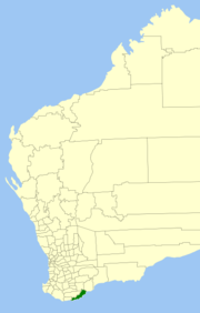 Location in Western Australia | |||||||||||||
| Population | 36,551 (2011 est)[1] | ||||||||||||
| • Density | 8.47599/km2 (21.9527/sq mi) | ||||||||||||
| Established | 1998 | ||||||||||||
| Area | 4,312.3 km2 (1,665.0 sq mi) | ||||||||||||
| Mayor | Dennis Wellington | ||||||||||||
| Council seat | Albany | ||||||||||||
| Region | Great Southern | ||||||||||||
| State electorate(s) | Albany | ||||||||||||
| Federal Division(s) | O'Connor | ||||||||||||
| Website | www.albany.wa.gov.au | ||||||||||||
| |||||||||||||
The City of Albany is a local government area in the Great Southern region of Western Australia, about 410 kilometres (255 mi) SSE of Perth, the capital of Western Australia. It covers an area of 4,312 square kilometres (1,665 sq mi), including the Greater Albany metropolitan area and the Port of Albany, as well as the surrounding agricultural district and some national parks. The City of Albany has an estimated population of 36,000 people as at June 2010.[2]
History
In 1871, the Albany Municipal Council was gazetted, and in 1896 the Albany Road Board followed. On 1 July 1961, they became respectively the Town and Shire Councils following changes to the Local Government Act.
On 1 July 1998, the two councils amalgamated to form the City of Albany.
Wards
The city has been divided into 7 wards, each of two councillors. Each councillor serves a four-year term, and half-elections are held every two years. The mayor is directly elected.
- Breaksea
- Frederickstown (central Albany)
- Hassell
- Kalgan
- Vancouver
- West
- Yakamia
Localities
|
|
|
National Parks and Reserves
- Bakers Junction Nature Reserve
- Bald Island Nature Reserve
- Mill Brook Nature Reserve
- North and South Sister Nature Reserves
- Tinkelelup Nature Reserve
- Torndirrup National Park
- Two Peoples Bay Nature Reserve
- Waychinicup National Park
- West Cape Howe National Park
References
- ↑ "3218.0 Regional Population Growth, Australia. Table 5. Estimated Resident Population, Local Government Areas, Western Australia". 30 March 2012. Retrieved 26 May 2012.
- ↑ Australian Bureau of Statistics (31 March 2011). "Regional Population Growth, Australia, 2009–10 - Western Australia". Retrieved 10 May 2011.
External links
| ||||||||||||||||||||||||||||||||||||||||||||||
Coordinates: 35°01′22″S 117°52′53″E / 35.0228°S 117.8814°E