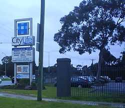
CityLife Church
| CityLife Church | |
|---|---|
|
| |
| Country |
|
| Denomination | Non-denominational (Pentecostal) |
| Website | citylifechurch.com |
| History | |
| Founded |
1967 as Waverley Christian Fellowship |
| Clergy | |
| Senior pastor(s) | Mark Conner |
CityLife Church, formerly known as Waverley Christian Fellowship, is a non-denominational megachurch in Melbourne, Australia. CityLife is a Pentecostal, multi-site church with weekly meetings in the municipalities of Knox, Casey and Manningham in Melbourne’s eastern suburbs. Weekly services are also held in Mandarin at the Knox campus. CityLife is the largest church in Melbourne and second-largest in Australia.[1] It has a strong emphasis on small groups. Its leadership team is headed by Senior Minister, Mark Conner.
The church runs Waverley Christian College, a Christian school with over 1200 students.[2]
History
The church was established in 1967 by Richard Holland. In 1983, Parkmore Full Gospel Church and its Christian school (now Waverley Christian College) merged with Waverley Christian Fellowship. In 1986, Kevin Conner became Senior Minister of the church (then about 600 members). Then in 1995, Mark Conner, Kevin's son, was appointed Senior Minister.[3]

In April 2006, CityLife Church Casey was established as a second campus of the Knox church. In March 2008, CityLife Church Manningham was established as a third campus.
Other information

CityLife has a children's church program (ROAR), a youth ministry, (EPIC Youth), and a Young Adults ministry.
CityLife Church also runs CityLife Community Care which provides a range of community services including counselling services, health-related services, emergency accommodation and other courses and support programs.
Along with some other large and growing churches in Melbourne, CityLife Church has drawn media attention,[1] in part because of its non-traditional style.[4]
See also
References
- ↑ 1.0 1.1 The Hallelujah chorus The Age, 24 December 2004
- ↑ Waverley Christian College website
- ↑ CityLife Church History
- ↑ Songs and a message The Age, 27 March 2005
External links
Coordinates: 37°52′41″S 145°12′54″E / 37.878131°S 145.214915°E